Area Overview for DE11 7BH
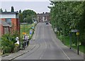
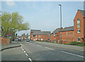
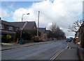
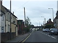
Photos of DE11 7BH
Area Information
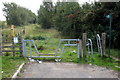
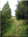
DE11 7BH is a small, tightly knit postcode area in North West Leicestershire, encompassing parts of Ashby Woulds, a civil parish known for its rural charm and proximity to the National Forest. The area covers just 4.3 hectares, housing 2,143 residents in a population density of 399 people per square kilometre. This makes it a compact, low-density community, typical of the surrounding countryside. The area is part of a broader region with a population of around 3,763 as of the 2011 census, though recent estimates suggest a decline. Notably, DE11 7BH includes a luxury residential park set within the National Forest, offering gated properties near the Derbyshire village of Overseal. Daily life here is shaped by its rural setting, with nearby settlements like Moira and Norris Hill contributing to a quiet, community-focused atmosphere. The area’s small size means it is ideal for those seeking a peaceful, low-traffic environment, with easy access to natural landscapes and local amenities.
- Area Type
- Postcode
- Area Size
- 4.3 hectares
- Population
- 2143
- Population Density
- 399 people/km²
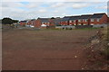
The property market in DE11 7BH is characterised by a high proportion of owner-occupied homes, with 61% of properties owned by residents rather than rented. The accommodation type is predominantly houses, which is unusual for a small postcode area but reflects the rural and semi-rural nature of the region. This suggests a market skewed towards established, family-oriented homes rather than apartments or flats. The limited size of the area means that housing stock is concentrated, with fewer options for buyers seeking a wide variety of properties. However, the presence of luxury lodges within the National Forest adds a niche appeal for those prioritising countryside living. Buyers should consider the small scale of the area, which may limit the availability of new developments or alternative housing types.
House Prices in DE11 7BH
Showing 40 properties
| Address | Type | Beds | Baths | Last Sale Price | Last Sale Date | |
|---|---|---|---|---|---|---|
| 19 Davenport Way, Woodville, Swadlincote, DE11 7BH | Semi-detached | 3 | 2 | £210,000 | May 2024 | |
| 33 Davenport Way, Woodville, Swadlincote, DE11 7BH | Semi-detached | 3 | 1 | £200,000 | Sep 2023 | |
| 31 Davenport Way, Woodville, Swadlincote, DE11 7BH | Retail | 3 | 1 | £195,000 | Oct 2022 | |
| 27 Davenport Way, Woodville, Swadlincote, DE11 7BH | Semi-detached | 3 | 2 | £185,000 | Sep 2021 | |
| 23 Davenport Way, Woodville, Swadlincote, DE11 7BH | Semi-detached | 3 | 1 | £175,000 | May 2021 | |
| 25 Davenport Way, Woodville, Swadlincote, DE11 7BH | Semi-detached | 3 | 2 | £174,950 | Jul 2020 | |
| 47 Davenport Way, Woodville, Swadlincote, DE11 7BH | Terraced | 3 | 1 | £157,000 | Feb 2020 | |
| 43 Davenport Way, Woodville, Swadlincote, DE11 7BH | Terraced | 3 | 1 | £160,000 | Aug 2019 | |
| 3 Davenport Way, Woodville, Swadlincote, DE11 7BH | Detached | 4 | 2 | £204,000 | Jun 2019 | |
| 7 Davenport Way, Woodville, Swadlincote, DE11 7BH | house | - | - | £160,000 | Sep 2018 |
Energy Efficiency in DE11 7BH
The lifestyle in DE11 7BH is shaped by its proximity to retail and transport hubs. Within practical reach are five retail venues, including Tesco Woodville, Asda Woodville Burton, and Aldi Castle, offering a range of shopping options for residents. The rail station in Burton adds to the area’s convenience, connecting residents to broader regional services. While the data does not list parks or leisure facilities explicitly, the presence of the National Forest nearby suggests opportunities for outdoor activities. The small-scale nature of the area means that amenities are compact but sufficient for daily needs, with a focus on practicality over extensive leisure options. The mix of retail and transport links supports a balanced lifestyle, blending rural tranquillity with necessary urban connectivity.
Amenities
Schools
DE11 7BH is served by three primary schools, all within practical reach of residents. Albert Village Community Primary School and Albert Village Primary School are both primary institutions, though specific Ofsted ratings are not listed for the latter. Moira Primary School, however, holds a ‘good’ Ofsted rating, indicating a strong educational offering for local families. The concentration of primary schools suggests a focus on early education, with Moira Primary’s rating providing a notable advantage for parents seeking quality schooling. The proximity of these schools to residential areas ensures convenience for families, reducing the need for long commutes. The mix of school types reflects the area’s commitment to supporting children’s education, though no secondary schools are mentioned in the data.
| Rank | School | Type | Entry gender | Ages |
|---|
Explore more schools in this area
Go to Schools tabDemographics
The population of DE11 7BH is predominantly adults aged 30–64, with a median age of 47. This suggests a mature, stable community with a focus on established households. Home ownership rates stand at 61%, indicating a strong presence of owner-occupied properties. The accommodation type is primarily houses, reflecting a residential character distinct from high-density housing. The predominant ethnic group is White, aligning with broader trends in the region. With a population density of 399 people per square kilometre, the area maintains a balance between residential comfort and space. The demographic profile suggests a community that values stability and long-term residency, with fewer transient populations. This is further supported by the low crime risk score of 67, which indicates a safer, more predictable environment for residents.
Household Size
Accommodation Type
Tenure
Ethnic Group
Religion
Household Composition
Age
Household Deprivation
NS-SEC
Explore more demographic insights in this area
Go to Demographics tabPlanning
Planning Constraints
- Flood RiskPremium
- Ramsar Wetland SitesPremium
- Area of Outstanding Natural BeautyPremium
- Protected Nature ReservePremium
- Protected WoodlandPremium