Area Overview for DE1 3GZ
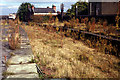
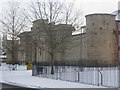
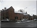
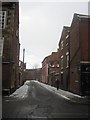
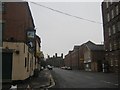
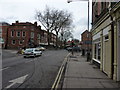
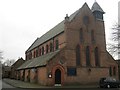
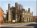
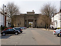
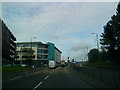
Photos of DE1 3GZ


Area Information
DE1 3GZ is a compact residential area in Derby, England, nestled along the River Derwent. Part of Darley Ward, it lies within the Derwent Valley Mills World Heritage Site, a testament to its 18th-century industrial roots. The area’s small size—2592 m²—hosts a population of 2599, creating a dense, tightly knit community. Its history as a mill village, established by the Evans family in the late 1700s, left a legacy of terraced housing, including the oldest surviving cluster housing in England. Today, the area blends historical architecture with modern living, though its compact nature means amenities and services are concentrated within a short walk or drive. The presence of Derby’s rail network, including nearby stations like Derby Railway Station, ensures easy access to the city’s core. While the area’s industrial past is evident, its current residents—primarily young adults—seek a mix of affordability and proximity to urban infrastructure. The high population density, however, underscores the need for efficient planning and community resources. For buyers, DE1 3GZ offers a unique blend of heritage and practicality, though its small footprint demands careful consideration of local constraints.
- Area Type
- Postcode
- Area Size
- 2592 m²
- Population
- 2599
- Population Density
- 11500 people/km²
The property market in DE1 3GZ is characterised by low home ownership (23%) and a reliance on flats as the primary accommodation type. This suggests a rental-dominated market, with limited opportunities for long-term homeownership. The area’s compact size means housing stock is concentrated, potentially leading to competition for available properties. Flats, often in terraced arrangements, reflect the 18th-century mill village planning that shaped the area. For buyers, this presents a challenge: the small footprint of DE1 3GZ limits the availability of larger homes or detached properties. The high population density also means that properties are likely to be in close proximity to one another, which may affect privacy and noise levels. However, the area’s proximity to Derby’s rail network and retail amenities could offset these drawbacks for commuters or those prioritising urban convenience. Prospective buyers should consider the transient nature of the community, as the high proportion of young adults may influence property turnover and market stability.
House Prices in DE1 3GZ
Showing 100 properties
| Address | Type | Beds | Baths | Last Sale Price | Last Sale Date | |
|---|---|---|---|---|---|---|
| Peak Court, Lodge Lane, Derby, DE1 3GZ | university_college | - | - | - | - | |
| Room 2 Flat 1A, Peak Court, Lodge Lane, Derby, DE1 3GZ | Unknown | - | - | - | - | |
| Room 5 Flat 2C, Peak Court, Lodge Lane, Derby, DE1 3GZ | Unknown | - | - | - | - | |
| Room 5 Flat 2B, Peak Court, Lodge Lane, Derby, DE1 3GZ | Unknown | - | - | - | - | |
| Room 5 Flat 3D, Peak Court, Lodge Lane, Derby, DE1 3GZ | Unknown | - | - | - | - | |
| Room 4 Flat 2D, Peak Court, Lodge Lane, Derby, DE1 3GZ | Unknown | - | - | - | - | |
| Room 6 Flat 2B, Peak Court, Lodge Lane, Derby, DE1 3GZ | Unknown | - | - | - | - | |
| Room 1 Flat 3B, Peak Court, Lodge Lane, Derby, DE1 3GZ | Unknown | - | - | - | - | |
| Room 1 Flat 1C, Peak Court, Lodge Lane, Derby, DE1 3GZ | Unknown | - | - | - | - | |
| Room 3 Flat 2A, Peak Court, Lodge Lane, Derby, DE1 3GZ | Unknown | - | - | - | - |
Energy Efficiency in DE1 3GZ
Daily life in DE1 3GZ is shaped by its proximity to retail, rail, and historical sites. The area’s retail options include Asda Derby, Sainsburys Nuns, and Sainsburys Kedleston, providing essentials within walking distance. These stores cater to both everyday needs and larger shopping trips, reducing the need for long commutes. The nearby rail network, with stations such as Derby Railway Station, ensures easy access to Derby’s cultural and commercial centres, including the city’s museums, theatres, and shopping districts. The River Derwent and surrounding heritage sites, like the Derwent Valley Mills World Heritage Site, offer recreational opportunities, though specific parks or green spaces are not detailed in the data. The compact nature of the area means that amenities are concentrated, fostering a sense of convenience but also limiting the availability of diverse leisure options. Residents benefit from a blend of historical significance and modern practicality, though the small footprint may require reliance on nearby areas for broader lifestyle choices.
Amenities
Schools
Residents of DE1 3GZ have access to three schools within practical reach. Central Community Nursery School provides early education, while Friar Gate House School is an independent institution offering alternative educational pathways. Castle School, categorised as ‘other,’ likely serves a broader age range or has a specific focus not detailed in the data. The mix of nursery and independent schools suggests a range of options for families, though the absence of state-funded secondary schools may require commuting to nearby areas. The presence of multiple schools indicates a focus on education within the community, though the types available reflect a blend of early years provision and specialist institutions. For families prioritising state education, additional research into nearby secondary schools beyond DE1 3GZ may be necessary. The schools listed are the closest options, but their types and quality are not rated in the data, so further local investigation would be advisable.
| Rank | School | Type | Entry gender | Ages |
|---|
Explore more schools in this area
Go to Schools tabDemographics
DE1 3GZ has a median age of 22, with the majority of residents aged 15–29. This young demographic shapes the area’s character, reflecting a community focused on early career development and education. Home ownership is low at 23%, with flats comprising the predominant accommodation type. This suggests a rental market dominated by younger tenants, likely students or workers commuting to Derby’s city centre. The area’s population density—over 1 million people per km²—highlights its compact nature, which may influence living conditions and community dynamics. The predominant ethnic group is White, though the data does not specify further diversity metrics. The high proportion of young adults may indicate a transient population, with limited long-term residential stability. For prospective buyers, this demographic profile suggests a market skewed toward short-term occupancy rather than family-oriented housing. The area’s small size and high density also mean that community interactions are frequent, though space constraints could impact quality of life for larger households.
Household Size
Accommodation Type
Tenure
Ethnic Group
Religion
Household Composition
Age
Household Deprivation
NS-SEC
Explore more demographic insights in this area
Go to Demographics tabPlanning
Planning Constraints
- Flood RiskPremium
- Ramsar Wetland SitesPremium
- Area of Outstanding Natural BeautyPremium
- Protected Nature ReservePremium
- Protected WoodlandPremium