Area Overview for DE1 3WB
Photos of DE1 3WB

Area Information
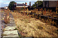
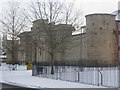
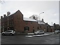
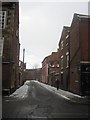
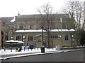
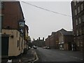
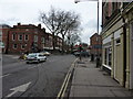
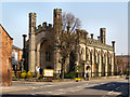
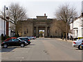
Living in DE1 3WB, a small residential cluster in Derby, England, means being part of a historically rich area with a distinct character. Situated along the River Derwent, this postcode falls within the Derwent Valley Mills World Heritage Site, a legacy of 18th-century industrial innovation. The area became part of Derby in 1968 and retains traces of its past as a mill village, with terraced housing like Flat Square and Brick Row dating back to the late 1700s. With a population of 2,599, DE1 3WB is a compact community where young adults (15–29 years) make up the majority. Daily life here is shaped by proximity to retail hubs, rail links, and the River Derwent’s scenic presence. While the area lacks large-scale amenities, its compact size offers a quiet, focused environment. The mix of historic architecture and modern infrastructure creates a unique blend of old and new, appealing to those seeking affordability and a connection to Derby’s industrial heritage. However, the high crime risk and limited home ownership (23%) suggest a rental-dominated market, which buyers should consider when evaluating long-term value.
- Area Type
- Postcode
- Area Size
- Not available
- Population
- 2599
- Population Density
- 11500 people/km²
The property market in DE1 3WB is characterised by a low home ownership rate (23%) and a predominance of flats. This suggests a rental market with limited opportunities for owner-occupation, likely due to the area’s small size and limited housing diversity. Flats are the primary accommodation type, which may indicate a focus on affordability and proximity to local services. For buyers, this means the area may not offer a wide range of property choices, particularly for those seeking larger homes or detached properties. The compact nature of DE1 3WB also means that property values and availability are closely tied to nearby areas in Derby. Buyers should consider the rental market dynamics and the potential for future development, though the lack of significant planning constraints (such as protected sites) may allow for some flexibility. However, the high crime risk could affect desirability, making it crucial for buyers to weigh safety considerations against other factors.
House Prices in DE1 3WB
No properties found in this postcode.
Energy Efficiency in DE1 3WB
Daily life in DE1 3WB is shaped by its proximity to retail and transport hubs. Residents can access five retail venues, including Asda Derby, Sainsburys Nuns, and Lidl Uttoxeter, providing a range of shopping and grocery options. The five nearby railway stations—Derby, Peartree, and Spondon—offer convenient links to Derby’s city centre and surrounding areas, supporting both commuting and leisure travel. While the area lacks large parks or recreational spaces, its location along the River Derwent offers natural scenery. The compact nature of DE1 3WB means amenities are within walking or short driving distance, enhancing convenience. However, the limited housing diversity and small size may restrict options for those seeking expansive lifestyles. The blend of retail, transport, and historic surroundings creates a functional, if modest, lifestyle for residents.
Amenities
Schools
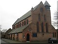
Residents of DE1 3WB have access to three nearby schools: Central Community Nursery School (nursery), Friar Gate House School (independent), and Castle School (other). The presence of an independent school suggests options for families seeking private education, while the nursery caters to younger children. Castle School’s classification as “other” may indicate a specialist or state-funded institution, though specific details about its curriculum or Ofsted rating are not provided. The mix of school types offers some choice for families, though the area’s small size may limit the range of educational options compared to larger urban centres. Parents should consider the proximity of these schools to their homes and the specific needs of their children, as well as the broader Derby school network for additional opportunities.
| Rank | School | Type | Entry gender | Ages |
|---|
Explore more schools in this area
Go to Schools tabDemographics
DE1 3WB has a median age of 22, with the majority of residents aged 15–29 years. This youthful demographic is reflected in the area’s housing stock, which consists predominantly of flats rather than detached homes. Home ownership is low at 23%, indicating that most residents rent their properties, likely due to the area’s small size and limited housing diversity. The predominant ethnic group is White, though specific data on other groups is not provided. The young age profile suggests a community focused on education, employment, and transient living, possibly linked to student populations or young professionals. The low home ownership rate may impact long-term stability for residents, as rental markets can be volatile. The area’s compact nature and limited amenities may also influence its appeal to families, though the presence of nearby schools and transport links offers some balance. Understanding these demographics is key to grasping the area’s character and its suitability for different buyer profiles.
Household Size
Accommodation Type
Tenure
Ethnic Group
Religion
Household Composition
Age
Household Deprivation
NS-SEC
Explore more demographic insights in this area
Go to Demographics tabPlanning
Planning Constraints
- Flood RiskPremium
- Ramsar Wetland SitesPremium
- Area of Outstanding Natural BeautyPremium
- Protected Nature ReservePremium
- Protected WoodlandPremium