Building
Built 1983–1990.
Multiple Residential Accommodation
This is not a sales listing. Propbar data is compiled for informational purposes.
Walkability
27 / 100
Car-dependent
Transit
59 / 100
Some transit
Closest essential
Spar -
10 min walk
Closest transport
Freehold
8 min walk
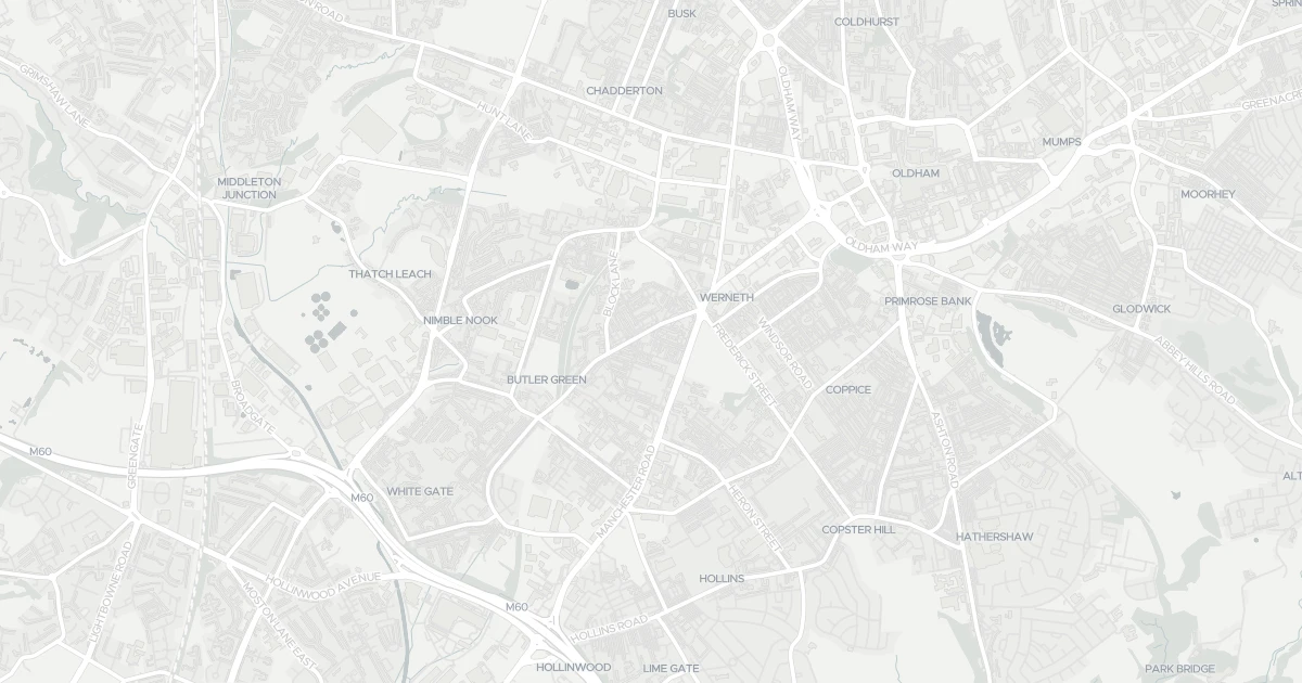
See nearby essentials and transport links overlaid on the property's location.
1 essential within a 15-min walk. Closest nearby: 5 grocers.
Convenience store · Top-up shop, long opening hours, alcohol licence · 0.71 km
Frozen discounter · Frozen bulk-buy, budget pricing · 1.28 km
Discount supermarket · Budget weekly shop, limited range, low prices · 1.33 km
Independent grocer · Local independent, top-up shop & specialty items · 1.42 km
Convenience store · Top-up shop, long opening hours, alcohol licence · 1.42 km
5 rail stations · 5 metro stops · 1 bus stop nearby. Check direct routes & frequency for your journeys.
Railway station · National Rail — check destinations & direct services · 2.61 km
Railway station · National Rail — check destinations & direct services · 3.09 km
Railway station · National Rail — check destinations & direct services · 5.43 km
Railway station · National Rail — check destinations & direct services · 6.57 km
Railway station · National Rail — check destinations & direct services · 6.72 km
Metro / Underground · Frequent urban transit, short-hop city travel · 0.48 km
Metro / Underground · Frequent urban transit, short-hop city travel · 1.00 km
Metro / Underground · Frequent urban transit, short-hop city travel · 1.16 km
Metro / Underground · Frequent urban transit, short-hop city travel · 1.37 km
Metro / Underground · Frequent urban transit, short-hop city travel · 1.70 km
Bus stop · Local bus services, check routes & frequency · 9.18 km
Scores blend proximity and density of nearby essentials and transport links. Closer, with more options, scores higher.
A flat at 4 Deva Square in Greater Manchester (OL9 7UX). It offers around 57 m² of floor space. The property holds an EPC rating of E, dates from 1983–1990 and is leasehold. Nearby shops include Spar -, Farmfoods Chadderton, Lidl Chadderton and Heron Hollins, the closest about 709 m away. The nearest stations are Freehold, South Chadderton and Westwood, around 480 m away. The Environment Agency rates this address at low risk of flooding.
Last Asking Price
—
Not currently listed
Propbar's Valuation Beta
£XXX
Range £XXX – £XXX
Price position
Price per sq ft
£XXX
Based on 614 ft²
Last Sold
—
No record
Market Timeline
—
Not currently listed
Times Listed
—
No history
Last Asking Rent
—
Not currently listed
Propbar's Valuation Beta
£XXX pcm
Range £XXX – £XXX pcm
Rent position
Gross Yield
X.X%
Annual return rate
Last Let
—
No record
Days on Market
—
Not currently listed
Times Listed
—
No history
1 of 12sections reviewed
Built 1983–1990.
Leasehold confirmed by HM Land Registry. Unlock to reveal owner, charges and restrictions.
No market history recorded for this property.
Sold prices, sales volumes and market pace for OL9 over the last 24 months.
Nothing on record for this property. See what's being applied for and built around it.
Rivers & sea, surface water and the 2080 climate outlook for this address.
Meets the minimum EPC E required to let the property today.
Safety score for OL9 7UX, the recent trend and offence-by-offence breakdown.
Pollutant levels, the official index and health context for this address.
Where OL9 7UX sits on the national prosperity ladder, and what drives it.
Admission chances, ratings and catchment status for 40 schools nearby.
1 essential within 15 min walk · 11 transport links nearby
We use cookies to provide you with the best experience. By continuing, you agree to our Cookie Policy .