Area Overview for DG9 9AE
Photos of DG9 9AE
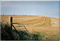
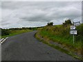
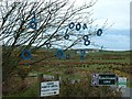
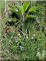
13 photos from this area
Area Information
Key information about the DG9 9AE including its size, population, and administrative classification.
- Area Type
- Postcode
- Area Size
- 69.0 hectares
- Population
- Not available
- Population Density
- Not available
House Prices in DG9 9AE
4
Properties
-
Average Sold Price
-
Lowest Price
-
Highest Price
Showing 4 properties
| Address | Type | Beds | Baths | Last Sale Price | Last Sale Date | |
|---|---|---|---|---|---|---|
| North Port O' Spittal, U 276 W From B 7042 To North Port Ospittal Farm, Stranraer, DG9 9AE | Detached | 3 | 2 | - | - | |
| Old Spittal Croft, U 67 W From B 7042 Near Knockinaam Wood To U 64 W, Portpatrick, Stranraer, DG9 9AE | Detached | 3 | 3 | - | - | |
| Port O'spittal Cottage, U 64 W From Portree Terrace To B 7042, Portpatrick, DG9 9AE | Detached | 4 | 2 | - | - | |
| Clearview, U 67 W From B 7042 Near Knockinaam Wood To U 64 W, Portpatrick, Stranraer, DG9 9AE | Detached | 4 | 4 | - | - |
Energy Efficiency in DG9 9AE
Amenities
Schools
| Rank | School | Type | Entry gender | Ages |
|---|
Explore more schools in this area
Go to Schools tabDemographics
Household Size
N/A
most common
Accommodation Type
N/A
most common
Tenure
N/A
majority
Ethnic Group
N/A
most common
Religion
N/A
most common
Household Composition
N/A
most common
Age
N/A
median
N/A
most common
Household Deprivation
N/A
with no deprivation
NS-SEC
N/A
in Lower managerial occupations
Explore more demographic insights in this area
Go to Demographics tabPlanning
Planning Constraints
- Flood RiskPremium
- Ramsar Wetland SitesPremium
- Area of Outstanding Natural BeautyPremium
- Protected Nature ReservePremium
- Protected WoodlandPremium
- Crime RiskPremium