Area Overview for West Calder
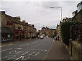
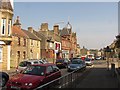
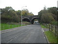
Photos of West Calder

Area Information
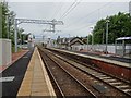
West Calder is a built-up area in Scotland covering 84 hectares, offering a compact yet functional living environment. Situated near major transport routes, it balances suburban comfort with accessibility to nearby towns. The area is served by five railway stations, including West Calder and Livingston South, linking residents to broader networks. Retail options are varied, with five notable stores such as Co-op Scotmid and Morrisons within practical reach, ensuring daily needs are met without long commutes. Digital connectivity is strong, with broadband and mobile scores in the upper 80s, supporting remote work and seamless online activity. While specific demographic details are not available, the area’s infrastructure and amenities suggest a mix of residents seeking convenience and connectivity. Its proximity to rail and retail, combined with reliable digital access, positions West Calder as a practical choice for those prioritising ease of movement and modern living essentials.
- Area Type
- Built Up Area 250
- Area Size
- 84.0 hectares
- Population
- Not available
- Population Density
- Not available
Living in West Calder provides access to a range of amenities within walking or short driving distance. Retail options include Co-op Scotmid, Co-op Polbeth, and Morrisons Dedridge, offering groceries and everyday essentials. The rail network, with stations like West Calder and Livingston South, connects residents to broader regional services and cultural hubs. While specific parks or leisure facilities are not detailed in the data, the presence of multiple retail and transport points suggests a community-oriented environment. These amenities contribute to a lifestyle where daily errands are efficient, and connectivity to nearby areas is seamless. The combination of retail, rail, and digital infrastructure ensures that residents can enjoy both local convenience and the flexibility to explore beyond West Calder.
Amenities
Schools
| Rank | School | Type | Entry gender | Ages |
|---|
Explore more schools in this area
Go to Schools tabDemographics
Household Size
Accommodation Type
Tenure
Ethnic Group
Religion
Household Composition
Age
Household Deprivation
NS-SEC
Explore more demographic insights in this area
Go to Demographics tabPlanning
Planning Constraints
- Crime RiskPremium