Area Overview for EH49 6EZ
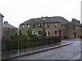
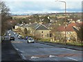
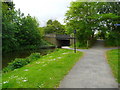
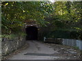
Photos of EH49 6EZ


Area Information
Living in EH49 6EZ involves residing within a tightly defined residential cluster in Scotland. This specific postcode covers just 3.1 hectares, creating a compact environment where neighbours are inevitably in close proximity. The area functions as a quiet pocket within the broader Linlithgow postcode region, offering residents a sense of sheltered domesticity without isolation. You will find a community focused on straightforward living, underscored by the limited physical footprint of the neighbourhood itself. Daily life here centres on making the most of immediate surroundings while relying on the wider town for broader needs. The small scale means that the local character is defined by its boundaries and immediate access to nearby rail and motorway corridors. There is no ambiguity about the location; it is a precise segment of the EH49 zone dedicated solely to housing. Prospective buyers appreciate the clarity of the landscape here, where every street and cul-de-sac falls within this narrow geographic ring.
- Area Type
- Postcode
- Area Size
- 3.1 hectares
- Population
- Not available
- Population Density
- Not available
The home ownership percentage in EH49 6EZ indicates whether residents primarily buy or rent, though specific national averages do not dictate the local reality without further breakdown. You are looking at a market where the primary accommodation type is residential housing, designed to meet the needs of those working in nearby towns. The area contains a finite number of properties due to its 3.1-hectare footprint, which limits inventory and creates a competitive environment for those seeking a specific address. Homes here range from standard semi-detached builds to potentially charming properties adapted for modern living. Because the postcode covers such a small residential cluster, the stock is not vast, meaning choice may be limited compared to larger towns like Linlithgow or Bathgate. Buyers generally seek stability in owner-occupied stock, yet the rental market may attract commuters relying on the frequent train services to Glasgow or Edinburgh. The property values rely on the convenience of the nearby retail and transport links rather than any local scarcity within the postcode itself.
House Prices in EH49 6EZ
Showing 41 properties
| Address | Type | Beds | Baths | Last Sale Price | Last Sale Date | |
|---|---|---|---|---|---|---|
| 27 Deanburn Park, Linlithgow, EH49 6EZ | Bungalow | 4 | 2 | - | - | |
| 26 Deanburn Park, Linlithgow, EH49 6EZ | Detached | 4 | 2 | - | - | |
| 15 Deanburn Park, Linlithgow, EH49 6EZ | Bungalow | 3 | 1 | - | - | |
| 40 Deanburn Park, Linlithgow, EH49 6EZ | Detached | 3 | 1 | - | - | |
| 25 Deanburn Park, Linlithgow, EH49 6EZ | Detached | 3 | 1 | - | - | |
| 20 Deanburn Park, Linlithgow, EH49 6EZ | Bungalow | 3 | 1 | - | - | |
| 32 Deanburn Park, Linlithgow, EH49 6EZ | Bungalow | 2 | 1 | - | - | |
| 22 Deanburn Park, Linlithgow, EH49 6EZ | Bungalow | 4 | 2 | - | - | |
| 6 Deanburn Park, Linlithgow, EH49 6EZ | Detached | 3 | 1 | - | - | |
| 24 Deanburn Park, Linlithgow, EH49 6EZ | Detached | - | - | - | - |
Energy Efficiency in EH49 6EZ
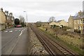
The lifestyle in EH49 6EZ benefits significantly from proximity to key amenities in Linlithgow and beyond. You can shop at Morrisons Daily, Aldi Linlithgow, and Tesco Linlithgow, all within practical reach for daily needs. Commuters enjoy frequent train services from Linlithgow Railway Station, Polmont Station, and Bathgate Railway Station, facilitating easy travel to surrounding cities. Local leisure activities centre around the nearby Manuel, Birkhill, and Kinneil stations, which offer free ferries across the Forth to Edinburgh or Fife. While there is no local cinema or large leisure complex within the 3.1-hectare boundary, the network of transport links places major entertainment options remarkably close. Residents appreciate the convenience of combining a quiet home with rapid access to the wider world via rail and road. The area effectively functions as a gateway, allowing you to enjoy a contained neighbourhood while accessing the full range of high street offerings and leisure facilities in Linlithgow and Bathgate.
Amenities
Schools
| Rank | School | Type | Entry gender | Ages |
|---|
Explore more schools in this area
Go to Schools tabDemographics
The community within EH49 6EZ is shaped entirely by its limited size, making demographic nuances specific to this small cluster rather than the wider region. Because the postcode covers only 3.1 hectares, population statistics flatten out into a singular residential identity rather than diverse subgroups. You will find a population made up of individuals and families settling into housing that defines this isolated segment of the area. The area hosts a mix of household types typical for a Scottish commuter belt zone, though specific breakdowns of single versus family households are not detailed for this exact code. Instead, the population reflects the demand for homes near the nearby rail stations and motorway links. Ownership of the property varies, blending those who bought long term with newer arrivals seeking proximity to Linlithgow amenities. The average age profile likely mirrors the regional trend of working-age commuters. Diversity and deprivation levels are not tracked at this micro-level, meaning the community feels cohesive and functionally similar to neighbouring postcodes.
Household Size
Accommodation Type
Tenure
Ethnic Group
Religion
Household Composition
Age
Household Deprivation
NS-SEC
Explore more demographic insights in this area
Go to Demographics tabPlanning
Planning Constraints
- Flood RiskPremium
- Ramsar Wetland SitesPremium
- Area of Outstanding Natural BeautyPremium
- Protected Nature ReservePremium
- Protected WoodlandPremium
- Crime RiskPremium