Area Overview for EH47 0JX
Photos of EH47 0JX

Area Information
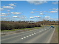
EH47 0JX is a small, tightly knit residential postcode area in Scotland, characterised by its compact footprint and proximity to essential services. Situated in a region that balances suburban comfort with accessible transport links, this area caters to those seeking a quieter lifestyle without sacrificing connectivity. The presence of multiple retail outlets, including Asda Polkemmet and Co-op Whitburn, ensures daily necessities are within reach, while nearby railway stations like Armadale and Bathgate provide straightforward access to larger towns and cities. Digital connectivity is a strong point, with fixed broadband rated at the highest possible score of 100, ensuring seamless online experiences for work, education, or entertainment. The area’s low flood risk and absence of protected natural sites suggest a stable, low-constraint environment for residents. While the community profile remains unquantified, the infrastructure and amenities suggest a practical, family-oriented appeal, particularly for those prioritising reliability and ease of access over urban vibrancy.
- Area Type
- Postcode
- Area Size
- Not available
- Population
- Not available
- Population Density
- Not available
House Prices in EH47 0JX
No properties found in this postcode.
Energy Efficiency in EH47 0JX
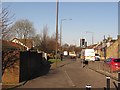
Living in EH47 0JX offers a blend of convenience and accessibility, with essential amenities within walking or short driving distance. Retail options include Asda Polkemmet, Co-op Whitburn, and Co-op Scotmid, providing a range of shopping and grocery needs. The proximity to multiple railway stations, such as Armadale and Bathgate, ensures easy access to broader regional networks, whether for commuting, leisure, or visiting nearby towns. While specific details on dining or leisure facilities are not provided, the presence of these retail and transport hubs suggests a community-oriented lifestyle where daily errands and travel are efficiently managed. The area’s compact nature and lack of environmental restrictions imply a focus on practical living, appealing to those who value reliability and straightforward access to services over sprawling urban or rural settings.
Amenities
Schools
| Rank | School | Type | Entry gender | Ages |
|---|
Explore more schools in this area
Go to Schools tabDemographics
Household Size
Accommodation Type
Tenure
Ethnic Group
Religion
Household Composition
Age
Household Deprivation
NS-SEC
Explore more demographic insights in this area
Go to Demographics tabPlanning
Planning Constraints
- Flood RiskPremium
- Ramsar Wetland SitesPremium
- Area of Outstanding Natural BeautyPremium
- Protected Nature ReservePremium
- Protected WoodlandPremium
- Crime RiskPremium