Area Overview for East Whitburn
Photos of East Whitburn

Area Information
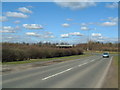
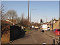
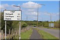
East Whitburn is a built-up area in Scotland, covering 37.9 hectares. It lies within a network of practical amenities, making it a convenient location for residents. The area is close to retail hubs such as Co-op Whitburn, Asda Polkemmet, and Aldi Longridge, offering everyday shopping needs. Rail connectivity is strong, with nearby stations like Armadale, Bathgate, and Addiewell providing access to broader transport networks. This proximity to both retail and rail infrastructure suggests a community focused on accessibility and convenience. The broadband score of 99 indicates excellent fixed-line internet quality, supporting remote work and digital lifestyles. While specific demographic details are not available, the area’s size and amenities suggest a mix of local residents and commuters. Living here balances practicality with the potential for a connected, modern lifestyle, though the exact character of the community remains to be explored further.
- Area Type
- Built Up Area 250
- Area Size
- 37.9 hectares
- Population
- Not available
- Population Density
- Not available
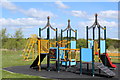
Daily life in East Whitburn is shaped by its proximity to essential amenities. The area’s retail offerings include Co-op Whitburn, Asda Polkemmet, and Aldi Longridge, providing a range of shopping options for groceries and household items. These stores are within walking or short driving distance, supporting a convenient lifestyle. Rail stations like Armadale and Bathgate connect residents to broader transport networks, facilitating travel to nearby towns and cities. While specific details about parks or leisure facilities are not provided, the presence of multiple retail and rail points suggests a focus on practicality. The area’s layout appears to prioritise accessibility, making it a logical choice for those seeking a balance between local convenience and regional connectivity.
Amenities
Schools
| Rank | School | Type | Entry gender | Ages |
|---|
Explore more schools in this area
Go to Schools tabDemographics
Household Size
Accommodation Type
Tenure
Ethnic Group
Religion
Household Composition
Age
Household Deprivation
NS-SEC
Explore more demographic insights in this area
Go to Demographics tabPlanning
Planning Constraints
- Crime RiskPremium