Area Overview for Broxburn (West Lothian)
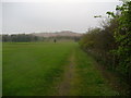
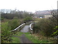
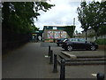
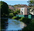
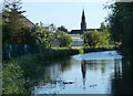
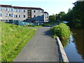
Photos of Broxburn (West Lothian)


Area Information
Broxburn is a built-up area in West Lothian that forms part of a larger residential conurbation. The town covers 3.5 square kilometres and sits approximately 55.9355 degrees north and 3.4707 degrees west. Originally known as Easter Strathbrock, it changed its name in 1600. Margery le Cheyne inherited the land around 1350, but the site changed hands following charters from King David I. A historic fire in the mid-fifteenth century nearly destroyed the settlement during local conflicts between the Earl of Douglas and Lord Crichton. James Young later pioneered shale oil extraction here in the nineteenth century, transforming the local economy. Today, you live in Broxburn as part of a community that blends modern housing with older industrial structures. Shale spoil tips, or bings, remain visible around the town, serving as a constant reminder of its shale oil heritage. The Almond Valley Heritage Centre preserves this legacy while the Union Canal passes through the area. You can walk from Broxburn to nearby Livingston or access the Edinburgh-Glasgow highroad for longer journeys. This location serves as a practical base for commuters seeking homes in Broxburn while maintaining links to major cities across Scotland.
- Area Type
- Built Up Area 250
- Area Size
- 3.5 km²
- Population
- Not available
- Population Density
- Not available
Your daily life includes stops at Aldi on Greendykes Road, the Co-op Scotmid, or Lidl. These supermarkets provide essentials with no need to drive far. You visit Kirkhill House to admire the architecture of a Category B listed building. The area features parks and sports centres where you exercise during weekends. The Almond Valley Heritage Centre serves as a focal point for cultural visits and educational activities. You walk through the shale bings that line the outskirts of the town. These industrial remnants provide a stark contrast to the green spaces found within Broxburn. You travel to Livingston North Railway Station for easy connections to the wider network. Hawes Pier or Rosyth Ferry Terminal offer alternative transport options if you prefer water travel. The character of the area remains a mix of quiet residential streets and accessible commercial zones. You find that everything you need stays within a short drive or walk. The conurbation with Uphall means you have more services available than in isolated villages.
Amenities
Schools
| Rank | School | Type | Entry gender | Ages |
|---|
Explore more schools in this area
Go to Schools tabDemographics
You move to a community defined by its working-class roots and evolving identity. The population structure reflects a mix of long-term residents and families attracted by the area's affordability. House ownership levels show that many families have established deep roots within Broxburn rather than renting short-term. You find that the age profile spans from students attending local institutions to retirees enjoying the proximity to Edinburgh. The household composition varies, with some families living in detached bungalows while others occupy modern flats. Accommodation types reveal a shift away from pure agricultural use towards residential housing since the shale oil industry declined by the 1950s. Economic history explains why you see fewer ultra-wealthy demographics and more middle and working-class residents. Specific deprivation data is not available from the current records, so you cannot quantify the exact level of poverty or wealth inequality in the town. Instead, you rely on the visible character of the neighbourhood, which includes historical estates and modern estates. The demographic picture suggests a stable, locally connected population rather than a transient workforce. This stability supports local schools and community groups that operate without the disruption of temporary residents.
Household Size
Accommodation Type
Tenure
Ethnic Group
Religion
Household Composition
Age
Household Deprivation
NS-SEC
Explore more demographic insights in this area
Go to Demographics tabPlanning
Planning Constraints
- Crime RiskPremium