Area Overview for Bathgate
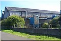
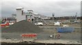
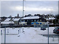
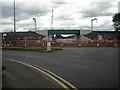
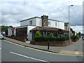
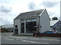
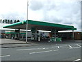
Photos of Bathgate

Area Information
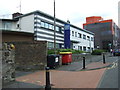
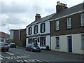
Living in Bathgate means residing in a substantial built-up area defined by its distinct local character rather than being absorbed into a larger city. This town covers 8.4 km², offering a compact footprint where homes, amenities, and transport links are within easy reach. You will find a community that balances suburban convenience with a strong sense of place, situated in the heart of Scotland. The area stands apart due to its specific infrastructure and accessibility, providing a practical base for daily life without the overwhelming scale of a major metropolitan centre. Residents here enjoy a straightforward environment where the layout supports both quiet residential streets and accessible town services. Bathgate operates as a self-contained locality where the physical boundaries of the built-up area create a clear identity. This makes it an attractive option for those seeking stability and knowability in their home environment. The town's size ensures you are not overwhelmed by vast distances, yet the network of homes accommodates a variety of living preferences. You are getting a defined geographical space with its own rhythm and pace, distinct from the surrounding regions. This specific configuration allows for a comfortable lifestyle centred on local amenities and well-connected transport options. It is a place where you understand your surroundings, with Bathgate serving as a reliable postcode for your daily needs. The area provides a grounded experience where the built environment works directly for the people calling it home.
- Area Type
- Built Up Area 250
- Area Size
- 8.4 km²
- Population
- Not available
- Population Density
- Not available
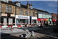
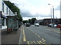
Your daily routine in Bathgate revolves around a set of practical amenities that are within easy reach of every home. You have five railway stations nearby, including Bathgate Railway Station, Armadale Railway Station, and Livingston North Railway Station, providing robust public transport links. Commuters can rely on a network of 5 rail options to travel beyond the immediate town limits. Local shopping is handled by 5 retail outlets, such as Morrisons Belvedere, Lidl Belvedere, and Farmfoods Bathgate, ensuring you have your groceries and essentials without a long drive. There is also one metro link via the Manuel, offering a distinct mode of transport for those who prefer it. These amenities create a convenient ecosystem where daily needs are met locally. You do not need to travel far for a meal at a specific venue or to pick up weekly supplies at Farmfoods. The presence of these named stores and transport hubs means Bathgate is self-supporting for most household requirements. Your commute to other parts of the region is straightforward thanks to the multiple railway choices available. The variety of transport and retail options ensures you never lack for basic services or connections. Living in Bathgate means having your essential services mapped out clearly around you.
Amenities
Schools
| Rank | School | Type | Entry gender | Ages |
|---|
Explore more schools in this area
Go to Schools tabDemographics
Understanding the community in Bathgate requires looking at the actual figures that define its residents. The area consists of a population living within these specific 8.4 km² boundaries, though precise population totals are not provided in the available data. Without specific numbers on age profiles or household types, we cannot describe the generational mix or family structures with exact percentages. The available information does not include data on home ownership levels or the spread of rented versus owner-occupied properties. Consequently, there is no specific figure available to confirm whether the majority of residents own their homes or rent their accommodation. Similarly, details regarding the diversity of the population or the distribution of single-person households versus families remain unspecified. Any discussion here is based only on the structural fact that this is a built-up area where people live. We cannot state deprivation statistics for Bathgate because the specific data is absent from the current records. Every claim about the demographic makeup would be a guess if it were not rooted in a concrete number. You must understand that without these specific data points, the community profile remains general by necessity. There are no exact percentages provided for any social or economic indicator. The characterization of the residents relies on the fact that they inhabit this specific locality. Any narrative about the diversity or age range must ignore specific claims until the data becomes available. The only verifiable fact is that this populated area functions as a residential zone for its inhabitants.
Household Size
Accommodation Type
Tenure
Ethnic Group
Religion
Household Composition
Age
Household Deprivation
NS-SEC
Explore more demographic insights in this area
Go to Demographics tabPlanning
Planning Constraints
- Crime RiskPremium