Area Overview for Armadale
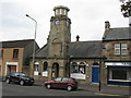
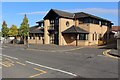
Photos of Armadale


Area Information
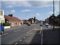
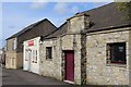
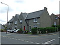
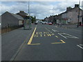
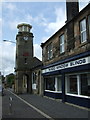
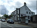
Living in Armadale means settling into a compact built-up area covering three square kilometres of land. You will find yourself in a town that functions as a self-contained community where daily needs are often located within close proximity to your home. This district in Scotland offers a specific type of town living where the cycle of work, leisure, and shopping can happen without excessive travel to adjacent cities. The town has grown into a significant local hub while maintaining its manageable scale. You are not living in a sprawling urban sprawl but rather in a defined town centre that has developed its own rhythm and character. The size of the area ensures that you can walk or take a short drive to reach key locations like the railway stations or local shops. Residents appreciate that the town is large enough to offer variety yet small enough to feel familiar. When you consider homes in Armadale, you are looking at a location that balances suburban convenience with a distinct town identity. It is a place where the built environment has matured to serve the needs of those who call it home.
- Area Type
- Built Up Area 250
- Area Size
- 3.0 km²
- Population
- Not available
- Population Density
- Not available
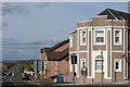
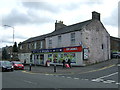
Your daily life in Armadale revolves around a convenient cluster of amenities that are within practical reach of your home. The town benefits from a solid selection of retail outlets, five of which are located nearby to serve your shopping needs. You have access to trusted brands such as Co-op Scotmid, Spar, and Asda Armadale, ensuring you can shop for groceries and essentials without travelling far. If you need to travel further, rail connections are readily available through Armadale Railway Station, Blackridge Railway Station, and Bathgate Railway Station, offering multiple options for reaching larger employment hubs. For those who prefer urban transport, the Manuel metro station provides another vital link for commute flexibility. Beyond shopping and transport, the area supports a lifestyle centred on convenience and accessibility. You do not need a car for every errand, as these amenities create a self-sufficient environment where you can manage daily tasks efficiently.
Amenities
Schools
| Rank | School | Type | Entry gender | Ages |
|---|
Explore more schools in this area
Go to Schools tabDemographics
The community composition in Armadale reflects the typical makeup of a Scottish town with a mix of residents across different life stages. Without specific demographic figures provided for age distribution or household types within this dataset, the general character of the population remains a focus for prospective buyers. The area attracts individuals, families, and professionals seeking a grounded lifestyle outside the major metropolitan centres of Glasgow or Edinburgh. You will join a neighbourhood where the demographic tapestry is woven from local families and workers who benefit from the town's amenities. The diversity of the population contributes to a stable community environment where neighbours often know one another. While exact percentages for home ownership or deprivation indices are not currently included in the available records, the nature of the housing stock points towards a balanced mix of owner-occupied and rental properties. The absence of extreme deprivation indicators suggests a relatively stable living environment. Residents in Armadale enjoy the benefits of a community that supports a range of family sizes and income levels typical of a established built-up area in the region.
Household Size
Accommodation Type
Tenure
Ethnic Group
Religion
Household Composition
Age
Household Deprivation
NS-SEC
Explore more demographic insights in this area
Go to Demographics tabPlanning
Planning Constraints
- Crime RiskPremium