Area Overview for Innerleithen
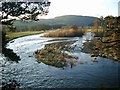
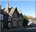
Photos of Innerleithen


Area Information
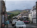
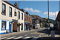
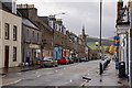
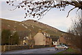
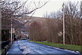
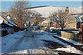
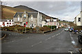
Living in Innerleithen means settling into a compact built-up area that spans just 1.1 square kilometres. You will find this town sits well within practical reach of larger market centres, yet it retains a distinct character as a standalone community in Scotland. Daily life here revolves around local convenience and proximity to essential services, making it a viable option for those seeking a home in Peebles or the wider Borders region. The area serves as a residential hub where residents can manage their weekly shop and access retail needs without long commutes to bustling high streets. Prospective homebuyers should understand that Innerleithen offers a tight-knit environment defined by its manageable size and clear boundaries. While the town lacks the sprawling infrastructure of a major city, its layout ensures that everyday activities remain accessible. You will encounter a setting where the pace of life is dictated by local rhythms rather than urban congestion. The community benefits from being close to significant retail anchors, which helps maintain a sense of self-sufficiency despite its modest footprint. This makes Innerleithen a practical choice for individuals or families who prioritise proximity to amenities over the excitement of metropolitan living.
- Area Type
- Built Up Area 250
- Area Size
- 1.1 km²
- Population
- Not available
- Population Density
- Not available
Your daily lifestyle in Innerleithen is anchored by a cluster of retail venues located within practical reach of the main town. The area enjoys easy access to Co-op Innerleithen, which serves as the primary local supermarket for fresh groceries and essentials. Just beyond the immediate border, larger options await in Peebles, including the M&S Peebles store and Sainsburys Peebles. These locations allow you to shop at major chains without leaving the broader region, providing a convenient mix of local and high-street needs. Residents also benefit from having at least five notable retail outlets scattered across theaccessible perimeter of the town. This network ensures you can purchase everything from daily bread to household electronics without lengthy drive times. The concentration of shopping facilities supports a self-sufficient routine where errands are manageable on foot or a short drive. Dining opportunities and leisure activities are often linked to these retail hubs, creating social spaces where neighbours interact. Living in Innerleithen grants you direct access to these amenities, ensuring your weekly chores and weekend outings remain efficient and straightforward.
Amenities
Schools
| Rank | School | Type | Entry gender | Ages |
|---|
Explore more schools in this area
Go to Schools tabDemographics
You will find that the community in Innerleithen is shaped by specific household dynamics and accommodation patterns unique to the local market. Evidence from area assessments indicates that the population composition reflects the broader trends found in similar Scottish towns. The specific profile of age groups and household types defines the social fabric of the 1.1 square kilometre zone. While exact demographic percentages are not included in the current assessment, the structure of local housing provides clues about where people choose to call home. Residents often gravitate towards properties that suit their family size or retirement needs, creating a steady mix of occupiers across the town. The level of home ownership versus renting influences how individuals engage with their neighbourhood, shaping local events and community involvement. Accommodation types range from standard family homes to those suitable for single occupants, catering to the practical needs of daily living. These structural elements determine the availability of schools near Innerleithen and the demand for specific local services. Understanding this demographic baseline helps you evaluate whether the town matches your requirements for living in Scotland's Borders.
Household Size
Accommodation Type
Tenure
Ethnic Group
Religion
Household Composition
Age
Household Deprivation
NS-SEC
Explore more demographic insights in this area
Go to Demographics tabPlanning
Planning Constraints
- Crime RiskPremium