Area Overview for Strathblane
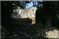
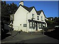
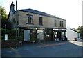
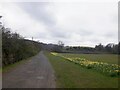
Photos of Strathblane


Area Information
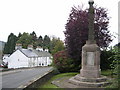
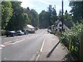
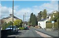
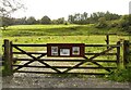
Strathblane is a built-up area covering 1.0 km² within Greater Glasgow, Scotland. It sits firmly within the built-up area classification, indicating an established residential community rather than a rural hamlet or scattered settlement. Living in Strathblane means you occupy a compact, concentrated neighbourhood where daily needs are relatively close to home. The small geographical footprint suggests a sense of enclosure and familiarity that often characterises suburban pockets on the fringes of larger cities. You will find yourself in a location that balances urban access with a degree of local distinctiveness. While specific population figures are not detailed in the current dataset, the classification as a built-up area confirms a established density of homes and residents. This density influences the daily rhythm of the neighbourhood, shaping everything from traffic patterns to local event organisation. You are situated in a part of Glasgow that has developed organically, likely benefiting from historical planning decisions that created cohesive streetscapes. The area size of 1.0 km² is manageable, allowing for relatively quick walks between key points if amenities are nearby. Residents here experience life in a defined space where the boundaries of the town are clear. Understanding the scale of Strathblane helps you visualise the commute times, walkability scores, and the overall pace of life you can expect. It is a practical choice for those seeking a specific footprint in a larger metropolitan region.
- Area Type
- Built Up Area 250
- Area Size
- 1.0 km²
- Population
- Not available
- Population Density
- Not available
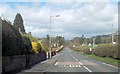
Residents of Strathblane have access to a range of amenities within practical reach, including five notable railway stations and five major retail outlets. The local transport network relies heavily on rail, with Milngavie Railway Station, Hillfoot Railway Station, and Bearsden Railway Station serving as your nearest travel hubs. These stations provide the core link to wider Glasgow employment centres and educational institutions. For your daily shopping needs, Spar Milngavie, M&S Milngavie Supermarket, and Tesco Glasgow are within a convenient distance. Having access to Tesco Glasgow means you can source a wide variety of groceries and household goods without travelling deep into the city centre. The presence of M&S and Spar indicates that you will find convenience stores for quick top-ups as well as full-service supermarkets for larger weekly shops. While specific leisure venues like parks, cinemas, or gyms are not listed in the data, the proximity to these transport and retail nodes suggests a lifestyle oriented towards efficient commuting and practical shopping. You do not need to travel far to complete your daily errands or catch public transport. The area functions as a sleeping community where key services are found just beyond the immediate 1.0 km² boundary but remain accessible by foot, cycle, or short bus ride. Your routine will likely centre on using these nearby stations to reach further destinations while relying on the listed supermarkets for local provisioning.
Amenities
Schools
| Rank | School | Type | Entry gender | Ages |
|---|
Explore more schools in this area
Go to Schools tabDemographics
Data on the specific demographic profile of Strathblane is not included in the provided records. Consequently, you cannot currently verify the age distribution, household composition, or diversity statistics for this location. Without available figures on the proportion of students, retirees, or families with children, it is impossible to construct a detailed portrait of who exactly lives in the homes of Strathblane. Similarly, information regarding home ownership rates or specific tenure types is absent from the dataset. You therefore lack the crucial data needed to determine if the community leans towards owner-occupiers, private renters, or social housing tenants. In many Scottish towns, demographics often shift gradually as property prices evolve, so historical trends might differ from current snapshots. The absence of these specific metrics means any description of the local community's character remains purely speculative rather than evidence-based. When evaluating neighbourhoods, the demographic mix often dictates school demand, local pub crowds, and noise levels. Without the numbers to confirm these trends for Strathblane, potential buyers must rely on external sources or neighbourhood visits to form their own opinions. The area stands as a 1.0 km² built-up zone, but the internal social fabric remains undefined by the available information.
Household Size
Accommodation Type
Tenure
Ethnic Group
Religion
Household Composition
Age
Household Deprivation
NS-SEC
Explore more demographic insights in this area
Go to Demographics tabPlanning
Planning Constraints
- Crime & SafetyPremium