Area Overview for Polmont
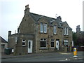
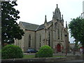
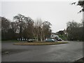
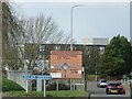
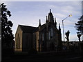
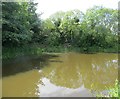
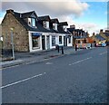
Photos of Polmont

Area Information
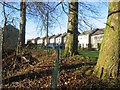
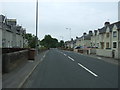
Polmont is a built-up area in Scotland covering a total of 6.2 square kilometres. This scale indicates a compact town where daily journeys often require little more than walking or a short car ride. Residents here experience a distinct Scottish rural-urban blend, characterised by low-rise housing and established village green spaces. The area functions as a practical residential hub for families and professionals seeking a connection to the wider region without the density of a major city. Living in Polmont means you benefit from a clear sense of community within a defined footprint that feels both spacious and manageable. The town centre serves as the primary social nucleus, surrounded by residential streets that offer a quiet domestic atmosphere. You will find that the area has developed into a stable part of the Stirling and Falkirk corridor, known for its accessible location near the M8 motorway. Prospective buyers often view Polmont as a practical choice for those who value established infrastructure over rapid urban development. The town retains a specific local identity separate from larger neighbouring cities, fostering a neighbourhood feel that can be appealing for long-term settlement.
- Area Type
- Built Up Area 250
- Area Size
- 6.2 km²
- Population
- Not available
- Population Density
- Not available
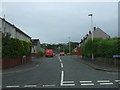
Daily life in Polmont centres on a convenient array of local amenities that serve the immediate residential needs of the community. Convenience is high, with five retail outlets located close by, including Spar, Tesco Falkirk, and Aldi Redding. You can handle your weekly shopping and daily errands without a long journey. Transport links are equally supportive, offering rail access through Polmont Station, Falkirk Grahamston Railway Station, and Falkirk High Railway Station. Four Metro bus routes, including services to Birkhill, Manuel, and Kinneil, provide flexible public transport options for local trips. The area includes open green spaces at Manuel, Kinneil, and nearby Birkhill, which offer residents a network of parks and recreational areas for walking or relaxation. You will find that the town supports a self-contained lifestyle where most essential services are accessible without leaving the broader neighbourhood. This balance of proximity to infrastructure and access to nature defines the character of living in Polmont for those who value convenience alongside outdoor space.
Amenities
Schools
| Rank | School | Type | Entry gender | Ages |
|---|
Explore more schools in this area
Go to Schools tabDemographics
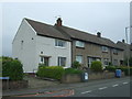
The demographic profile of Polmont reflects a typical family-oriented suburban community. While specific age bracket statistics are not included in the current records for this area, the accommodation structure suggests a stable population mix. The housing stock consists almost entirely of owner-occupied properties, creating a environment where long-term residents form the core of the community. This high rate of home ownership often correlates with families choosing to stay in the area for generations. You will not find a significant presence of private purpose-built rented accommodation, as the housing is predominantly comprised of semi-detached and detached houses. This contrasts sharply with areas where private rentals dominate the market, meaning tenants are less likely to make up the majority of the population. The dominance of ownership indicates a community invested in the local environment and existing streetscapes. For anyone considering moving into Polmont, the area offers the stability of a non-transient neighbourhood. Demographic data points to a neighbourhood built on established residential patterns rather than transient student or service-worker housing.
Household Size
Accommodation Type
Tenure
Ethnic Group
Religion
Household Composition
Age
Household Deprivation
NS-SEC
Explore more demographic insights in this area
Go to Demographics tabPlanning
Planning Constraints
- Crime RiskPremium