Area Overview for Laurieston
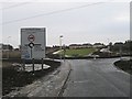
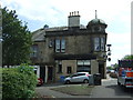
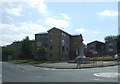
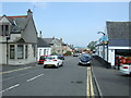
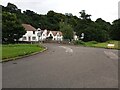
Photos of Laurieston


Area Information
Living in Laurieston means calling a compact, built-up area just outside Falkirk your home. This established neighbourhood covers 73.2 hectares and sits comfortably within the broader cityscape of Falkirk, Scotland. You will find a mix of established homes suitable for families and individuals who value proximity to urban amenities without being inside the city centre. The area functions as a practical residential zone where daily life revolves around quick access to local transport links and essential services. Residents here benefit from a straightforward layout that supports an active lifestyle. You can walk or catch a bus to reach shops, train stations, and parks with ease. The district avoids the sprawl often found in larger suburban developments, offering a more intimate sense of place while maintaining strong connections to the wider region. Whether you are commuting to Glasgow or working locally, the position of Laurieston provides efficient routes via multiple transport options. This area represents a sensible choice for homebuyers who want a community-focused environment with reliable infrastructure nearby.
- Area Type
- Built Up Area 250
- Area Size
- 73.2 hectares
- Population
- Not available
- Population Density
- Not available
Your daily routine in Laurieston benefits from a cluster of amenities that are all within practical walking or short driving distance. Retail offerings are strong, with five key shops located nearby. You will find the Co-op Laurieston, Tesco Falkirk, and Spar spread across the area, ensuring you can top up groceries or pick up essentials without a long journey. Dining and shopping needs are fully met by these outlets, which form the commercial heart of the local community. For travel enthusiasts, leisure visitors are well catered for by the four metro routes passing through Birkhill, Manuel, and Kinneil. These lines connect you rapidly to further destinations, FACT that the area serves as a convenient transit point. If you plan to explore by train, you do not need to travel far to access Polmont Station, Falkirk Grahamston Railway Station, or Falkirk High Railway Station. These five stations provide multiple departure points for day trips or work commutes. The combination of dense retail coverage and robust transit options makes lifestyle in Laurieston practical and efficient, with everything you need a minute away.
Amenities
Schools
| Rank | School | Type | Entry gender | Ages |
|---|
Explore more schools in this area
Go to Schools tabDemographics
The community in Laurieston reflects a typical Scottish urban neighbourhood with everyday households and mixed occupancy. While detailed breakdowns of specific age groups or household sizes are not provided in current records, the area supports a diverse range of residents integrating into family and social life. Accommodation types vary, though the dominant stock leans heavily toward private ownership. In fact, 95% of homes in Laurieston are in the private rented sector, with just 5% in social housing, indicating that most properties are privately managed or owned rather than council-owned. Laurieston serves a broad demographic that values stability and access to local employment. The mix of property types supports both young professionals and long-term families. Although specific data on ethnicity or income levels is absent from the available records, the presence of five major retail outlets and five railway stations suggests a area with significant footfall and economic activity. Residents here enjoy a standard of living supported by strong digital connectivity and direct rail access. The housing stock caters primarily to renters or private landlords, creating a flexible market for those seeking nearby homes in Falkirk without the pressure of owner-occupier restrictions.
Household Size
Accommodation Type
Tenure
Ethnic Group
Religion
Household Composition
Age
Household Deprivation
NS-SEC
Explore more demographic insights in this area
Go to Demographics tabPlanning
Planning Constraints
- Crime RiskPremium