Area Overview for Grangemouth
Photos of Grangemouth


Area Information
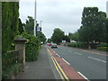
Living in Grangemouth offers a distinct experience defined by its identity as a built-up area covering 13.4 km² in Scotland. This location serves as a practical base for residents who require reliable access to wider networks while enjoying a town centre environment. You will find a community where daily life revolves around straightforward access to essential services and major transport links. The area is characterised by its integration with the broader Scottish highway system, making it a logical choice for commuters working beyond the immediate surrounds. Homes here cater to families and individuals seeking stability in a region with a clear footprint and defined boundaries. The town operates with a functional rhythm, avoiding the chaos of high-density cities while providing enough urban infrastructure to support modern living. You can expect a straightforward environment where local needs are met without excessive travel. Families often appreciate the balance between quiet residential streets and proximity to commercial hubs. The size of the area ensures that you are not isolated from amenities, yet you retain a sense of locality. Living in Grangemouth means choosing a place that prioritises connectivity and practicality over cosmopolitan flair.
- Area Type
- Built Up Area 250
- Area Size
- 13.4 km²
- Population
- Not available
- Population Density
- Not available
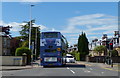
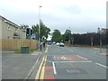
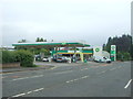
Your daily life in Grangemouth is enriched by a concentration of amenities within easy reach of your doorstep. Five retail options operate near the town centre, including Spar, Asda Grangemouth, and Iceland Grangemouth, ensuring you can handle weekly shopping and grocery needs without lengthy journeys. Transport convenience is further supported by five nearby railway stations, including Polmont Station and Falkirk High Railway Station, which provide vital links to regional employment and leisure destinations. Four metro stops, such as Birkhill and Kinneil, offer additional connectivity for shorter trips around the surrounding built-up area. These services mean you rarely need to rely solely on private car travel for routine errands. The proximity of these venues creates a lifestyle where work, shopping, and travel are logistically simple. You can fulfill household requirements locally while maintaining access to broader opportunities via the rail network. The combination of retail flexibility and transport frequency defines the practical rhythm of life here. Living in Grangemouth allows you to balance convenience with access, making it a sensible choice for those prioritising efficient daily routines.
Amenities
Schools
| Rank | School | Type | Entry gender | Ages |
|---|
Explore more schools in this area
Go to Schools tabDemographics
Household Size
Accommodation Type
Tenure
Ethnic Group
Religion
Household Composition
Age
Household Deprivation
NS-SEC
Explore more demographic insights in this area
Go to Demographics tabPlanning
Planning Constraints
- Crime RiskPremium