Area Overview for FK9 4JE
Photos of FK9 4JE
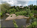
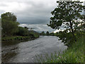
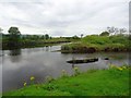
![Bridge of Allan, Allan Water [5] in FK9 4JE](https://images.propbar.co.uk/images/geograph/25/44/2544589_120.jpg)
19 photos from this area
Area Information
Key information about the FK9 4JE including its size, population, and administrative classification.
- Area Type
- Postcode
- Area Size
- 13.1 hectares
- Population
- Not available
- Population Density
- Not available
House Prices in FK9 4JE
22
Properties
-
Average Sold Price
-
Lowest Price
-
Highest Price
Showing 22 properties
| Address | Type | Beds | Baths | Last Sale Price | Last Sale Date | |
|---|---|---|---|---|---|---|
| 15C Inverallan Road, Bridge Of Allan, FK9 4JE | Flat | 2 | 1 | - | - | |
| 13D Inverallan Road, Bridge Of Allan, FK9 4JE | Maisonette | 3 | 2 | - | - | |
| 48 Inverallan Road, Bridge Of Allan, FK9 4JE | Flat | 2 | 1 | - | - | |
| 11B Inverallan Road, Bridge Of Allan, FK9 4JE | Detached | 3 | 2 | - | - | |
| Castleton, 11A Inverallan Road, Bridge Of Allan, FK9 4JE | Detached | 3 | - | - | - | |
| 36 Inverallan Road, Bridge Of Allan, FK9 4JE | Flat | - | - | - | - | |
| 38 Inverallan Road, Bridge Of Allan, FK9 4JE | Flat | - | - | - | - | |
| 40 Inverallan Road, Bridge Of Allan, FK9 4JE | Flat | - | - | - | - | |
| 46 Inverallan Road, Bridge Of Allan, FK9 4JE | Flat | - | - | - | - | |
| 34 Inverallan Road, Bridge Of Allan, FK9 4JE | Flat | 2 | - | - | - |
Page 1 of 3
Energy Efficiency in FK9 4JE
Amenities
Schools
| Rank | School | Type | Entry gender | Ages |
|---|
Explore more schools in this area
Go to Schools tabDemographics
Household Size
N/A
most common
Accommodation Type
N/A
most common
Tenure
N/A
majority
Ethnic Group
N/A
most common
Religion
N/A
most common
Household Composition
N/A
most common
Age
N/A
median
N/A
most common
Household Deprivation
N/A
with no deprivation
NS-SEC
N/A
in Lower managerial occupations
Explore more demographic insights in this area
Go to Demographics tabPlanning
Planning Constraints
- Flood RiskPremium
- Ramsar Wetland SitesPremium
- Area of Outstanding Natural BeautyPremium
- Protected Nature ReservePremium
- Protected WoodlandPremium
- Crime RiskPremium