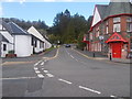
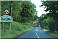
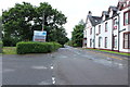
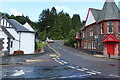
Area Overview for FK8 3UT
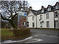
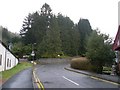
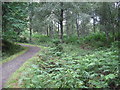
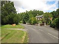
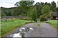
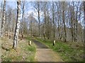
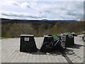
Photos of FK8 3UT

Area Information
FK8 3UT is a small residential cluster nestled in Scotland, covering 8.4 hectares. This area is defined by its compact size and proximity to natural and community amenities. Residents benefit from easy access to Trossachs Pier, a key ferry point, and Co-op Aberfoyle, a local retail hub. The area’s character is shaped by its integration with the surrounding landscape, offering a blend of rural tranquillity and practical connectivity. While the broadband score is poor at 27, mobile coverage is robust at 81, supporting reliable communication for daily needs. The presence of protected woodland adds to the area’s ecological significance, though it also introduces considerations for planning and land use. Living here suits those seeking a quiet, nature-oriented lifestyle, balanced with essential services within reach. The community’s small footprint means a close-knit environment, where local landmarks and natural features define the rhythm of daily life.
- Area Type
- Postcode
- Area Size
- 8.4 hectares
- Population
- Not available
- Population Density
- Not available
House Prices in FK8 3UT
Showing 2 properties
| Address | Type | Beds | Baths | Last Sale Price | Last Sale Date | |
|---|---|---|---|---|---|---|
| Tennis Court 148M From Scottish Outdoor Education Centre, 52M From Unnamed Road, Footpath From Queens Crescent To Dounans Residential Camp School, Aberfoyle, FK8 3UT | Leisure | - | - | - | - | |
| Dounans Outdoor Centre, Main Street, Aberfoyle, FK8 3UT | shop | - | - | - | - |
Energy Efficiency in FK8 3UT
FK8 3UT offers a lifestyle shaped by its proximity to natural and local amenities. Residents can access Co-op Aberfoyle, a retail hub that provides essential shopping and services. The nearby Trossachs Pier serves as a gateway to water-based activities and connects the area to broader regional travel options. The presence of protected woodland adds to the area’s appeal for nature enthusiasts, though it also influences land use constraints. The small size of the area means that daily life is centred around these key points, creating a self-contained environment. While the amenities are limited in number, they are strategically located to serve the community’s practical needs, blending convenience with the tranquillity of the surrounding landscape.
Amenities
Schools
| Rank | School | Type | Entry gender | Ages |
|---|
Explore more schools in this area
Go to Schools tabDemographics
Household Size
Accommodation Type
Tenure
Ethnic Group
Religion
Household Composition
Age
Household Deprivation
NS-SEC
Explore more demographic insights in this area
Go to Demographics tabPlanning
Planning Constraints
- Flood RiskPremium
- Ramsar Wetland SitesPremium
- Area of Outstanding Natural BeautyPremium
- Protected Nature ReservePremium
- Protected WoodlandPremium
- Crime RiskPremium