Area Overview for FK8 1HB
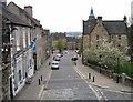
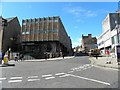
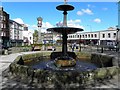
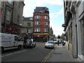
Photos of FK8 1HB


Area Information
FK8 1HB is a small residential cluster in Scotland, covering 278 square metres. It lies in a quiet, compact area with a distinct local character, positioned near key transport hubs and retail centres. The postcode area is ideal for those seeking a balance between accessibility and tranquillity, with proximity to Stirling’s rail network and major supermarkets. Daily life here is shaped by the nearby amenities, including four rail stations such as Stirling and Bridge of Allan, which connect residents to wider regional routes. The area’s compact size means it’s well-suited to those who prefer a walkable, community-focused lifestyle. While the population details are not specified, the area’s infrastructure suggests a mix of residents, from commuters to local workers. The absence of natural constraints like AONB or protected woodlands means development is unencumbered, though flood risk remains negligible. This makes FK8 1HB a practical choice for buyers seeking a small, manageable area with reliable connectivity and access to essential services.
- Area Type
- Postcode
- Area Size
- 278 m²
- Population
- Not available
- Population Density
- Not available
House Prices in FK8 1HB
Showing 1 properties
| Address | Type | Beds | Baths | Last Sale Price | Last Sale Date | |
|---|---|---|---|---|---|---|
| House Of Henderson, 6 Friars Street, Stirling, FK8 1HB | retail_financial | - | - | - | - |
Energy Efficiency in FK8 1HB
Living in FK8 1HB offers access to a range of practical amenities within walking or short driving distance. Retail options include Sainsburys Stirling, M&S Stirling, and Iceland Stirling, providing everyday shopping convenience. The area’s rail stations, such as Dunblane and Stirling, connect residents to broader networks, facilitating travel to work, leisure, or social events. While specific details on parks or leisure facilities are not provided, the lack of protected natural areas suggests a focus on urban convenience rather than rural scenery. The compact nature of the postcode means residents can reach essential services quickly, supporting a lifestyle that balances practicality with accessibility. The absence of major planning constraints like AONB or Ramsar sites also implies a flexible environment for local development and community activities.
Amenities
Schools
| Rank | School | Type | Entry gender | Ages |
|---|
Explore more schools in this area
Go to Schools tabDemographics
Household Size
Accommodation Type
Tenure
Ethnic Group
Religion
Household Composition
Age
Household Deprivation
NS-SEC
Explore more demographic insights in this area
Go to Demographics tabPlanning
Planning Constraints
- Flood RiskPremium
- Ramsar Wetland SitesPremium
- Area of Outstanding Natural BeautyPremium
- Protected Nature ReservePremium
- Protected WoodlandPremium
- Crime RiskPremium