Area Overview for FK7 9JA
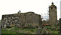
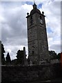
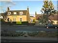
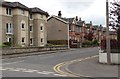
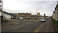
Photos of FK7 9JA


Area Information
Living in FK7 9JA means residing within a very specific and compact residential cluster in Scotland. The postcode covers an area size of just 3,444 square metres, which indicates a focused settlement rather than a sprawling suburb. This small footprint suggests a tightly knit neighbourhood where residents are aware of one another. You live in a distinct environment where the local character is defined by its intimacy and limited boundaries. Prospective buyers looking for homes in FK7 9JA will find this location offers a contained community feel. It is not a large catchment area but a precise living zone for those who prefer a defined space. The area functions as a self-contained residential unit close to larger towns. Your daily life revolves around this small cluster while accessing wider services nearby. This postcode represents a specific address point rather than a broad town district. The sense of place comes from being part of this concentrated living arrangement in the Scottish market.
- Area Type
- Postcode
- Area Size
- 3444 m²
- Population
- Not available
- Population Density
- Not available
The property market for FK7 9JA is characterised by a total lack of available sales data in the current records. You cannot determine whether homes in FK7 9JA are primarily owner-occupied or if the area relies heavily on rentals because ownership figures are absent. The specific accommodation types, such as the number of detached houses, semi-detached properties, or flats, are not listed for this postcode. This gap prevents any analysis of housing stock density or the typical floor plan sizes available to buyers. Current data does not include average sale prices or market trends for this cluster. Without home ownership percentages or tenure data, you cannot assess the stability of the local property values. The market description for FK7 9JA remains non-existent in digital databases. Potential buyers interested in flats or bungalows here lack the statistical backing needed to make informed comparisons with wider regions in Scotland.
House Prices in FK7 9JA
Showing 9 properties
| Address | Type | Beds | Baths | Last Sale Price | Last Sale Date | |
|---|---|---|---|---|---|---|
| 50 Craigend Road, St Ninians, Stirling, FK7 9JA | Semi-detached | 3 | - | - | - | |
| 49 Craigend Road, St Ninians, Stirling, FK7 9JA | Semi-detached | - | - | - | - | |
| 53 Craigend Road, St Ninians, Stirling, FK7 9JA | Semi-detached | - | - | - | - | |
| 55 Craigend Road, St Ninians, Stirling, FK7 9JA | house | - | - | - | - | |
| 51 Craigend Road, St Ninians, Stirling, FK7 9JA | Semi-detached | - | - | - | - | |
| 47 Craigend Road, St Ninians, Stirling, FK7 9JA | Semi-detached | - | - | - | - | |
| 46 Craigend Road, St Ninians, Stirling, FK7 9JA | Semi-detached | - | - | - | - | |
| 48 Craigend Road, St Ninians, Stirling, FK7 9JA | house | - | - | - | - | |
| 44 Craigend Road, St Ninians, Stirling, FK7 9JA | house | - | - | - | - |
Energy Efficiency in FK7 9JA
Residents of FK7 9JA benefit from five retail stores within practical reach, providing essential shopping options. Notable venues nearby include Lidl St, Morrisons Daily, and Waitrose Stirling. These supermarkets allow you to source groceries without travelling far beyond your immediate neighbourhood. The area also has four railway stations accessible from FK7 9JA, enhancing your travel flexibility. Stirling Railway Station, Bridge of Allan Railway Station, and Dunblane Railway Station are all within commuting distance. This transport mix means you can walk or take a short drive to reach a larger train hub for city travel. Dining and specialty shopping await at Lidl St and Morrisons Daily for quick essentials. Waitrose offers a higher-end grocery experience nearby if you prefer premium tills. Your lifestyle includes easy access to these specific named amenities without long journeys. The convenience of these neighbours defines the daily rhythm for anyone living at this postcode.
Amenities
Schools
| Rank | School | Type | Entry gender | Ages |
|---|
Explore more schools in this area
Go to Schools tabDemographics
Demographic profiles for FK7 9JA are not provided in the available records. Without specific figures on age distribution or household composition, general statements about the community composition remain unsupported by data. Similarly, there is no information available regarding household size or dependency ratios for this precise postcode. Data regarding income deprivation levels is also absent for this location, so no conclusions can be drawn about economic pressure in the street. You cannot verify the level of diversity or the mix of full-time workers versus students in this specific square metre without clearer records. The home ownership percentage remains unknown as no statistics cover this area. Accommodation type distribution is missing from the dataset entirely. Deprivation index scores are not included for FK7 9JA. Consequently, you must rely on external knowledge or local word-of-mouth to understand who actually lives in these homes. No verified figures exist to confirm the cultural makeup of the residents in this small Scottish postcode.
Household Size
Accommodation Type
Tenure
Ethnic Group
Religion
Household Composition
Age
Household Deprivation
NS-SEC
Explore more demographic insights in this area
Go to Demographics tabPlanning
Planning Constraints
- Flood RiskPremium
- Ramsar Wetland SitesPremium
- Area of Outstanding Natural BeautyPremium
- Protected Nature ReservePremium
- Protected WoodlandPremium
- Crime RiskPremium