Area Overview for FK7 7SR
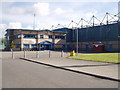
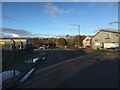
Photos of FK7 7SR
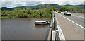
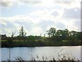
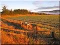
![Cambuskenneth Haugh [2] in FK7 7SR](https://images.propbar.co.uk/images/geograph/26/17/2617777_120.jpg)
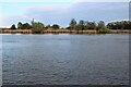
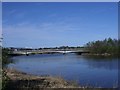
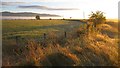
![Stirling, Muirton [2] in FK7 7SR](https://images.propbar.co.uk/images/geograph/29/04/2904852_120.jpg)
29 photos from this area
Area Information
Key information about the FK7 7SR including its size, population, and administrative classification.
- Area Type
- Postcode
- Area Size
- 3.2 hectares
- Population
- Not available
- Population Density
- Not available
House Prices in FK7 7SR
6
Properties
-
Average Sold Price
-
Lowest Price
-
Highest Price
Showing 6 properties
| Address | Type | Beds | Baths | Last Sale Price | Last Sale Date | |
|---|---|---|---|---|---|---|
| 17 Bakery, Springkerse Retail Park, Stirling, FK7 7SR | shop | - | - | - | - | |
| Unit 17 Morrisons Filling Station, Springkerse Retail Park, Stirling, FK7 7SR | Retail | - | - | - | - | |
| 17 Butchers And Deli And Fish, Springkerse Retail Park, Stirling, FK7 7SR | shop | - | - | - | - | |
| Morrisons Supermarket, 17 Springkerse Retail Park, Stirling, FK7 7SR | shop | - | - | - | - | |
| 17 Restaurant, Springkerse Retail Park, Stirling, FK7 7SR | restaurant_cafe | - | - | - | - | |
| 17 Dry Cleaners, Springkerse Retail Park, Stirling, FK7 7SR | shop | - | - | - | - |
Energy Efficiency in FK7 7SR
Amenities
Schools
| Rank | School | Type | Entry gender | Ages |
|---|
Explore more schools in this area
Go to Schools tabDemographics
Household Size
N/A
most common
Accommodation Type
N/A
most common
Tenure
N/A
majority
Ethnic Group
N/A
most common
Religion
N/A
most common
Household Composition
N/A
most common
Age
N/A
median
N/A
most common
Household Deprivation
N/A
with no deprivation
NS-SEC
N/A
in Lower managerial occupations
Explore more demographic insights in this area
Go to Demographics tabPlanning
Planning Constraints
- Flood RiskPremium
- Ramsar Wetland SitesPremium
- Area of Outstanding Natural BeautyPremium
- Protected Nature ReservePremium
- Protected WoodlandPremium
- Crime RiskPremium