Area Overview for FK4 2AT
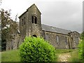
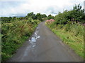
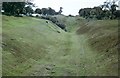
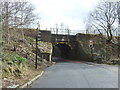
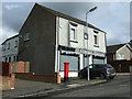
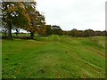
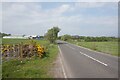
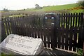
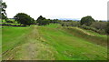
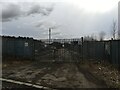
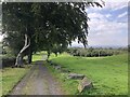
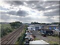
Photos of FK4 2AT
Area Information
FK4 2AT is a small residential postcode area in Scotland, covering 5.3 hectares. It is a compact cluster of homes, likely serving a local community with straightforward needs. The area is positioned near key infrastructure, including multiple railway stations and retail outlets, making it practical for daily life. Residents here are likely to value accessibility, with nearby amenities such as Spar, Tesco Bonnybridge, and rail links to Camelon, Larbert, and Falkirk High stations. The small size of the area suggests a tight-knit community, where familiarity with local services and transport routes is common. While the area lacks major landmarks or expansive green spaces, its proximity to rail networks and basic retail options supports a functional lifestyle. For those prioritising convenience over sprawling landscapes, FK4 2AT offers a straightforward, no-frills environment. The area’s character is defined by its practicality, with homes likely designed for ease of living rather than grandeur. Living here would suit individuals or families seeking a base that is easy to navigate, with essential services within reach.
- Area Type
- Postcode
- Area Size
- 5.3 hectares
- Population
- Not available
- Population Density
- Not available
House Prices in FK4 2AT
Showing 22 properties
| Address | Type | Beds | Baths | Last Sale Price | Last Sale Date | |
|---|---|---|---|---|---|---|
| 77 Broomhill Road, High Bonnybridge, FK4 2AT | Flat | 3 | 1 | - | - | |
| 75 Broomhill Road, High Bonnybridge, FK4 2AT | Semi-detached | 2 | 1 | - | - | |
| 89 Broomhill Road, High Bonnybridge, FK4 2AT | Detached | 5 | 2 | - | - | |
| Churchview, 87 Broomhill Road, High Bonnybridge, FK4 2AT | Bungalow | 2 | 2 | - | - | |
| Lyndeen Cottage, 61 Broomhill Road, High Bonnybridge, FK4 2AT | Detached | 5 | 3 | - | - | |
| 63 Broomhill Road, High Bonnybridge, FK4 2AT | Semi-detached | 3 | 2 | - | - | |
| 81 Broomhill Road, High Bonnybridge, FK4 2AT | Bungalow | 4 | - | - | - | |
| 67 Broomhill Road, High Bonnybridge, FK4 2AT | Semi-detached | - | - | - | - | |
| 73 Broomhill Road, High Bonnybridge, FK4 2AT | house | - | - | - | - | |
| 69 Broomhill Road, High Bonnybridge, FK4 2AT | Semi-detached | - | - | - | - |
Energy Efficiency in FK4 2AT
The area’s proximity to retail options such as Spar, Tesco Bonnybridge, and other local stores ensures residents can access daily essentials without long journeys. The presence of multiple railway stations adds to the convenience, allowing quick travel to nearby towns for work, leisure, or shopping. While the area lacks detailed information on parks or leisure facilities, the small residential cluster suggests a focus on practical living rather than expansive recreational spaces. The nearby rail links also open up opportunities for weekend outings or cultural experiences in larger centres. For those prioritising ease of access to basic amenities and transport, FK4 2AT provides a straightforward, functional lifestyle. The character of daily life here is likely shaped by the rhythm of local retail and rail services, with a strong emphasis on connectivity to the surrounding region.
Amenities
Schools
| Rank | School | Type | Entry gender | Ages |
|---|
Explore more schools in this area
Go to Schools tabDemographics
Household Size
Accommodation Type
Tenure
Ethnic Group
Religion
Household Composition
Age
Household Deprivation
NS-SEC
Explore more demographic insights in this area
Go to Demographics tabPlanning
Planning Constraints
- Flood RiskPremium
- Ramsar Wetland SitesPremium
- Area of Outstanding Natural BeautyPremium
- Protected Nature ReservePremium
- Protected WoodlandPremium
- Crime RiskPremium