Area Overview for FK3 9LE
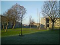
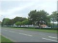
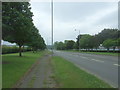
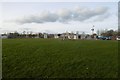
Photos of FK3 9LE


Area Information
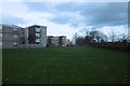
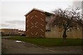
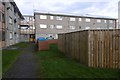
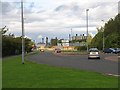
FK3 9LE is a small, focused residential postcode in Scotland, covering just 3,302 square metres. It sits in a compact cluster of homes, suggesting a tight-knit community with limited expansion. The area’s proximity to multiple rail and metro stations—such as Polmont, Falkirk Grahamston, and Falkirk High—makes it well-connected to regional transport networks. Digital connectivity is robust, with a broadband score of 98 and mobile coverage of 84, ensuring reliable internet for both work and leisure. While crime data is unavailable for Scotland, the area has a low flood risk and no overlap with protected natural sites, which may appeal to buyers seeking stability. The presence of multiple Spar stores nearby hints at a practical, everyday retail focus, and the area’s rail links suggest it is positioned to serve commuters or those needing access to larger towns. Living here likely involves a balance of local convenience and regional connectivity, with minimal environmental constraints. The small size of the area means it is likely to be a quiet, low-traffic spot, though its appeal may depend on individual preferences for proximity to urban or rural settings.
- Area Type
- Postcode
- Area Size
- 3302 m²
- Population
- Not available
- Population Density
- Not available
The property market in FK3 9LE is shaped by its small size and limited housing stock. While specific ownership figures are not provided, the presence of multiple rail and metro stations suggests the area may cater to commuters or those seeking access to transport hubs. The absence of protected natural areas or planning constraints could make it a straightforward place to buy, with fewer restrictions on development. However, the small area size means the housing stock is likely limited to a few hundred properties, possibly including terraced or semi-detached homes. Given the proximity to rail services, it may attract buyers looking for a base near transport links rather than a standalone residential community. The lack of detailed ownership data means it is unclear whether the area is predominantly owner-occupied or rental-focused, but the compact nature of the postcode suggests a mix of local residents and those using the area as a transit point. Buyers should consider the limited scope for expansion and the potential for properties to be part of a broader regional network.
House Prices in FK3 9LE
Showing 37 properties
| Address | Type | Beds | Baths | Last Sale Price | Last Sale Date | |
|---|---|---|---|---|---|---|
| 29 Glenbervie Road, Grangemouth, FK3 9LE | Flat | 2 | 1 | - | - | |
| 11 Glenbervie Road, Grangemouth, FK3 9LE | Flat | 2 | 1 | - | - | |
| 67 Glenbervie Road, Grangemouth, FK3 9LE | Flat | 2 | 1 | - | - | |
| 17 Glenbervie Road, Grangemouth, FK3 9LE | Flat | 2 | 1 | - | - | |
| 13 Glenbervie Road, Grangemouth, FK3 9LE | Flat | 2 | 1 | - | - | |
| 61 Glenbervie Road, Grangemouth, FK3 9LE | Flat | 2 | 1 | - | - | |
| 23 Glenbervie Road, Grangemouth, FK3 9LE | Flat | 2 | - | - | - | |
| 9 Glenbervie Road, Grangemouth, FK3 9LE | Terraced | 3 | - | - | - | |
| 37 Glenbervie Road, Grangemouth, FK3 9LE | Flat | - | - | - | - | |
| 27 Glenbervie Road, Grangemouth, FK3 9LE | Flat | - | - | - | - |
Energy Efficiency in FK3 9LE
Daily life in FK3 9LE is shaped by its proximity to retail and transport hubs. The area has five Spar stores, offering basic grocery and convenience services, which suggests a focus on practical needs over luxury shopping. Rail and metro stations provide access to broader regional amenities, though specific details about nearby leisure or dining options are not available. The absence of major parks or recreational areas implies that residents may rely on nearby towns for outdoor activities. The compact nature of the postcode means amenities are likely concentrated within walking or short driving distance, catering to those who prefer convenience over sprawling landscapes. While the area lacks detailed information on cultural or entertainment venues, its transport links position it as a practical base for those prioritizing connectivity over extensive local facilities.
Amenities
Schools
| Rank | School | Type | Entry gender | Ages |
|---|
Explore more schools in this area
Go to Schools tabDemographics
Household Size
Accommodation Type
Tenure
Ethnic Group
Religion
Household Composition
Age
Household Deprivation
NS-SEC
Explore more demographic insights in this area
Go to Demographics tabPlanning
Planning Constraints
- Flood RiskPremium
- Ramsar Wetland SitesPremium
- Area of Outstanding Natural BeautyPremium
- Protected Nature ReservePremium
- Protected WoodlandPremium
- Crime RiskPremium