Area Overview for FK15 0HG
Photos of FK15 0HG


Area Information
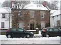
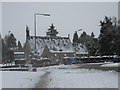
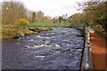
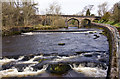
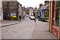
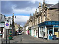
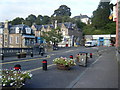
FK15 0HG is a small, tightly knit residential area in central Scotland, covering just 4.5 hectares. Its compact size means it is a quiet, low-density cluster of homes, likely surrounded by open land or natural features. The area is well-connected to nearby towns via rail, with three stations within practical reach: Dunblane, Bridge of Allan, and Stirling. These links provide easy access to urban centres, making it a convenient base for commuters or those seeking a balance between rural tranquillity and city proximity. The broadband score here is poor, scoring 29 out of 100, which may pose challenges for remote workers relying on high-speed internet. However, mobile coverage is strong, with a score of 81, ensuring reliable connectivity on the move. The area’s flood risk is minimal, and while it includes protected woodland, there are no major environmental restrictions. This makes FK15 0HG a viable option for those prioritising safety and natural surroundings without the constraints of designated conservation areas.
- Area Type
- Postcode
- Area Size
- 4.5 hectares
- Population
- Not available
- Population Density
- Not available
House Prices in FK15 0HG
Showing 1 properties
| Address | Type | Beds | Baths | Last Sale Price | Last Sale Date | |
|---|---|---|---|---|---|---|
| Dunblane Hydro, Perth Road, Dunblane, FK15 0HG | hotel | - | - | - | - |
Energy Efficiency in FK15 0HG
Living in FK15 0HG offers access to a range of practical amenities within walking or short driving distance. Retail options include Tesco Dunblane, M&S Dunblane SF, and Co-op Stirling, providing everyday shopping needs. These stores cater to both routine purchases and larger weekly shopping trips. The area’s rail stations connect residents to broader networks, enabling easy access to cultural hubs, dining, and leisure opportunities in nearby towns. While the specific details of local parks or recreational spaces are not provided, the presence of protected woodland suggests opportunities for nature walks or outdoor activities. The compact nature of the area means daily life is likely centred around nearby amenities, fostering a community-oriented lifestyle. For those who enjoy a mix of convenience and natural surroundings, FK15 0HG strikes a balance between accessibility and seclusion.
Amenities
Schools
| Rank | School | Type | Entry gender | Ages |
|---|
Explore more schools in this area
Go to Schools tabDemographics
Household Size
Accommodation Type
Tenure
Ethnic Group
Religion
Household Composition
Age
Household Deprivation
NS-SEC
Explore more demographic insights in this area
Go to Demographics tabPlanning
Planning Constraints
- Flood RiskPremium
- Ramsar Wetland SitesPremium
- Area of Outstanding Natural BeautyPremium
- Protected Nature ReservePremium
- Protected WoodlandPremium
- Crime RiskPremium