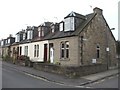
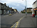
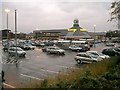
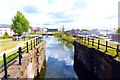
Area Overview for Falkirk
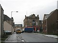
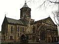
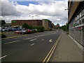
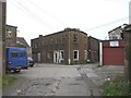
Photos of Falkirk
Area Information
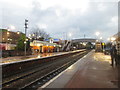
Falkirk is a distinct built-up area located in Scotland, covering a total size of 8.7 km². This compact footprint defines a dense, urban environment where daily life revolves around accessible facilities and efficient transport links. Residents here rely on a network that includes five retail options and five railway stations, featuring key hubs such as Falkirk Grahamston and Falkirk High. The area's character is shaped by its proximity to major supermarkets like Farmfoods, Morrisons, and Asda, which serve the immediate residential population. Living in Falkirk means balancing the convenience of these amenities with the need for reliable connectivity. The locality offers two metro services at Birkhill and Manuel, providing straightforward access for commuters. This town functions as a practical base for households that value proximity to work and shopping without the sprawl of larger cities. The sheer density ensures that essential services are never far away, creating a functional living space for families and professionals alike. You will find a community defined by these concrete infrastructural realities rather than abstract concepts of suburbia.
- Area Type
- Built Up Area 250
- Area Size
- 8.7 km²
- Population
- Not available
- Population Density
- Not available
The lifestyle in Falkirk centres on a core selection of amenities that are within practical reach of your home. Five retail outlets serve the immediate need for daily shopping, with Farmfoods Falkirk, Morrisons Falkirk, and Asda Falkirk standing out as primary destinations. This retail presence ensures that groceries and household essentials are always accessible. Transport links further enhance the quality of life, with five railway stations providing vital connections. Falkirk Grahamston Railway Station and Falkirk High Railway Station serve as major hubs, while Camelon Railway Station offers additional routes. Beyond rail, two metro services operate from Birkhill and Manuel, catering to local transport requirements. Residents can navigate the area and travel beyond it using these established public transport options. Supermarkets and train stations are integrated into the fabric of daily life, reducing the time spent commuting to basic needs. The locality functions as a self-contained community where most routine activities can be completed locally. This convenience is the defining feature of the resident experience.
Amenities
Schools
| Rank | School | Type | Entry gender | Ages |
|---|
Explore more schools in this area
Go to Schools tabDemographics
The community in Falkirk is defined by specific demographic patterns that shape the local culture. A significant proportion of the population consists of children and young people under the age of 16, indicating a strong family presence within the 8.7 km² zone. Nearly half of the population comprises couples without children, while a smaller segment includes single individuals living alone. Lone parents form another identifiable group within this social fabric. Regarding home ownership, roughly 40 per cent of residents own their homes outright or carry a mortgage, while the remaining 60 per cent rent or reside with other relatives. The housing stock varies, with 28 per cent living in semi-detached homes, 26 per cent in terraced properties, and 10 per cent in flats or maisonettes. Other residents occupy detached houses, bungalows, or caravans. This mix reflects a diverse range of household needs and financial situations. Understanding these figures helps you grasp the dynamic between younger families, childless couples, and renting households. Demographics like these directly influence the local schools and community centres that serve Falkirk.
Household Size
Accommodation Type
Tenure
Ethnic Group
Religion
Household Composition
Age
Household Deprivation
NS-SEC
Explore more demographic insights in this area
Go to Demographics tabPlanning
Planning Constraints
- Crime RiskPremium