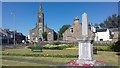
Area Overview for Bannockburn
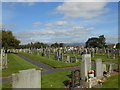
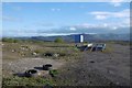
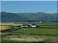
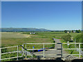
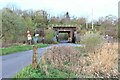
Photos of Bannockburn


Area Information
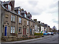
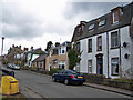
Living in Bannockburn offers a compact, well-connected slice of Scottish urban life. Covering 79.7 hectares, the area is small enough to feel cohesive yet diverse in its offerings. Residents benefit from proximity to key retail hubs, including Co-op Scotmid and M&S Stirling M9 Moto SF, which cater to daily needs. Rail connectivity is strong, with Stirling, Alloa, and Bridge of Allan stations within practical reach, linking the area to broader networks. Digital infrastructure is a standout feature: broadband quality scores at 98, which is excellent, and mobile coverage at 81, deemed good. This supports both remote work and seamless internet use. Bannockburn’s character is defined by its balance of convenience and accessibility, appealing to professionals and families seeking a base near transport and amenities. While the area’s population isn’t specified, its size and infrastructure suggest a community focused on practical living. For those prioritising connectivity and proximity to services, Bannockburn provides a solid foundation for daily life.
- Area Type
- Built Up Area 250
- Area Size
- 79.7 hectares
- Population
- Not available
- Population Density
- Not available
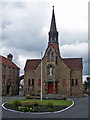
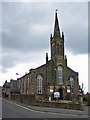
Bannockburn’s lifestyle is shaped by its accessible amenities. Retail options include Co-op Scotmid, Co-op Stirling, and M&S Stirling M9 Moto SF, providing everything from groceries to clothing. These shops are within practical reach, supporting daily errands and leisure shopping. The rail stations—Stirling, Alloa, and Bridge of Allan—offer easy access to cultural, professional, and recreational hubs beyond the immediate area. While parks and leisure facilities aren’t detailed in the data, the presence of multiple retail and transport nodes suggests a community-oriented environment. The area’s compact size means amenities are close to homes, reducing travel time. This blend of convenience and connectivity makes Bannockburn suitable for those valuing accessibility without sacrificing the comfort of a settled neighbourhood.
Amenities
Schools
| Rank | School | Type | Entry gender | Ages |
|---|
Explore more schools in this area
Go to Schools tabDemographics
Household Size
Accommodation Type
Tenure
Ethnic Group
Religion
Household Composition
Age
Household Deprivation
NS-SEC
Explore more demographic insights in this area
Go to Demographics tabPlanning
Planning Constraints
- Crime RiskPremium