Area Overview for The Stewartry of Kirkcudbright
Photos of The Stewartry of Kirkcudbright


Area Information
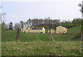
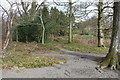
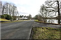
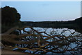
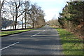
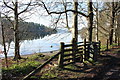
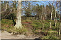
Living in The Stewartry of Kirkcudbright offers a distinctly rural lifestyle within the ceremonial county of southern Scotland. You will find an expansive area covering 1,735.4 square kilometres, where daily life revolves around natural landscapes rather than dense urban centres. This region provides homes in The Stewartry of Kirkcudbright for those seeking space and proximity to the outdoors, yet it remains a relatively isolated location compared to major Scottish cities. The community here is defined by its connection to the land, and residents often value the slower pace above metropolitan convenience. When considering living in The Stewartry of Kirkcudbright, you should be prepared for a lifestyle that embraces the wider Scottish countryside rather than city amenities. The sheer size of the area means distances between villages can be significant, making transport options a primary consideration for your daily routine. You must weigh the tranquility of this setting against the practicalities of accessing services in neighbouring regions. The distinctive character of the Stewartry ensures a lived experience that differs markedly from other parts of the country.
- Area Type
- Ceremonial Counties Region
- Area Size
- 1735.4 km²
- Population
- Not available
- Population Density
- Not available
Demographics
The community within The Stewartry of Kirkcudbright reflects the broader patterns typical of rural Scotland, where population density is low and household structures vary. Specific figures regarding age profiles, household types, and diversity are not available in the current data, but the large land area of 1,735.4 km² suggests a dispersed population. Home ownership levels and accommodation types remain unquantified, preventing a precise description of whether the housing stock is dominated by owners or tenants. You cannot assess deprivation trends without the necessary statistical breakdowns for this specific ceremonial county. Because detailed demographic statistics are absent, any claim about the social composition of The Stewartry of Kirkcudbright would be an assumption rather than a fact. Living here means adapting to a community structure that lacks the granular data visible in more populated regions. You must rely on general observations of rural life rather than specific census figures when understanding who calls this area home. The community exists independently of the specific metrics usually provided for urban or semi-urban centres.
Household Size
Accommodation Type
Tenure
Ethnic Group
Religion
Household Composition
Age
Household Deprivation
NS-SEC
Explore more demographic insights in this area
Go to Demographics tabPlanning
Planning Constraints
- Crime RiskPremium