Area Overview for Tain
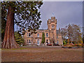
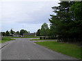
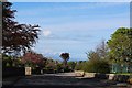
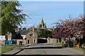
Photos of Tain
Area Information
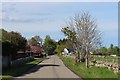
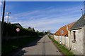
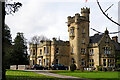
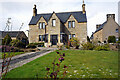
Tain is a compact, well-defined built-up area in Scotland, covering 1.6 km². Its small size contributes to a tightly knit community, where daily life is shaped by proximity to local amenities and transport links. The area’s charm lies in its balance of practicality and accessibility, with two railway stations—Tain and Fearn—offering connections to nearby towns and cities. Retail options are plentiful, including Co-op Tain, Tesco Highland, and Lidl Tain, ensuring residents have access to essential shopping without long commutes. Digital connectivity is a standout feature, with a broadband score of 98, indicating near-perfect fixed-line internet quality. This supports both remote work and everyday online needs, while mobile coverage, rated 75, provides reliable connectivity for most users. Tain’s appeal is further enhanced by its quiet, residential character, making it suitable for those seeking a stable, community-focused environment without sacrificing modern convenience.
- Area Type
- Built Up Area 250
- Area Size
- 1.6 km²
- Population
- Not available
- Population Density
- Not available
Living in Tain offers a blend of convenience and local character, with amenities within easy reach. The retail landscape is well-developed, featuring Co-op Tain, Tesco Highland, and Lidl Tain, which provide essential shopping options for daily needs. These stores cater to a range of preferences, from fresh produce to household goods, reducing the need for long trips to larger centres. The presence of two railway stations—Tain and Fearn—adds to the area’s accessibility, connecting residents to nearby towns and cities. While parks and leisure facilities are not explicitly detailed in the data, the proximity to rail and retail suggests a lifestyle focused on practicality and community. For those who value a balance between local amenities and broader connectivity, Tain delivers a straightforward, functional living experience.
Amenities
Schools
| Rank | School | Type | Entry gender | Ages |
|---|
Explore more schools in this area
Go to Schools tabDemographics
Household Size
Accommodation Type
Tenure
Ethnic Group
Religion
Household Composition
Age
Household Deprivation
NS-SEC
Explore more demographic insights in this area
Go to Demographics tabPlanning
Planning Constraints
- Crime & SafetyPremium