Area Overview for Portree
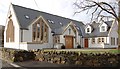
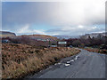
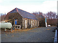
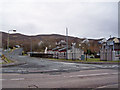
Photos of Portree

Area Information
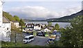
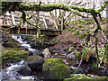
Portree is a compact built-up area in Scotland, covering 1.5 km². Its small size means the community is tightly knit, with residents often knowing their neighbours. The area’s proximity to the Portree Ferry Terminal provides direct access to the surrounding islands, making it a practical base for those who travel by sea. Locals benefit from two Co-op stores, offering daily essentials and a sense of convenience. While the area lacks large-scale retail or entertainment hubs, its simplicity suits those seeking a quieter lifestyle. The presence of the ferry terminal also suggests a connection to broader regional networks, though the area’s appeal is likely rooted in its coastal location and the practicality of its amenities. For buyers, Portree offers a straightforward living experience, with limited but functional services and a focus on accessibility over urban sprawl.
- Area Type
- Built Up Area 250
- Area Size
- 1.5 km²
- Population
- Not available
- Population Density
- Not available
Living in Portree offers a straightforward lifestyle, with essential amenities within practical reach. Two Co-op stores provide basic shopping needs, ensuring daily errands can be completed without venturing far. The Portree Ferry Terminal is a key feature, offering direct access to the surrounding islands and facilitating travel for residents who rely on maritime transport. While the area lacks large supermarkets, cafes, or entertainment venues, its simplicity caters to those prioritising convenience over variety. The limited retail options suggest a community-focused approach, where local needs are met by small-scale services. For buyers, this means a lifestyle centred on practicality, with a focus on essential services and the ferry’s role in connecting the area to broader networks.
Amenities
Schools
| Rank | School | Type | Entry gender | Ages |
|---|
Explore more schools in this area
Go to Schools tabDemographics
Household Size
Accommodation Type
Tenure
Ethnic Group
Religion
Household Composition
Age
Household Deprivation
NS-SEC
Explore more demographic insights in this area
Go to Demographics tabPlanning
Planning Constraints
- Crime RiskPremium