Area Overview for Muir of Ord
Photos of Muir of Ord


Area Information
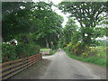
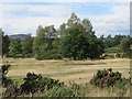
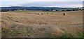
Muir of Ord is a compact built-up area in the Scottish Highlands covering 1.7 square kilometres. This small town forms the administrative centre of the historic region of Ross-shire. You will find a residential community centred around Muir of Ord itself, serving as a practical base for those working in the wider Highlands. The concentration of housing within such a small footprint creates a distinct village feel despite its location away from the biggest urban centres. Residents enjoy close access to the surrounding countryside while remaining within walking distance of essential local services. The scale of the area ensures that daily needs are met without requiring extensive travel. Many people choose Muir of Ord because it balances accessibility with the relative peace of the Highlands. Whether you are commuting to Inverness or working remotely, the town offers a grounded environment where life moves at a steady pace. The area functions as a community hub for the northern Highlands, providing necessary infrastructure on a human scale. You will notice that the layout supports a mixed-use dynamic where homes sit near local businesses and public transport links. This compact nature makes Muir of Ord an attractive option for families seeking connection without the congestion of major cities.
- Area Type
- Built Up Area 250
- Area Size
- 1.7 km²
- Population
- Not available
- Population Density
- Not available
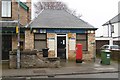
Residents of Muir of Ord benefit from immediate access to essential retail and transport infrastructure. You will find five local shops available within practical reach, specifically including Co-op Muir of, Co-op Scotmid, and Spar. These venues handle your weekly grocery shopping and essential household purchases without needing to travel far. Beyond retail, rail connectivity forms a major part of your daily transport options. You can access rail services at Muir of Ord Railway Station, Beauly Railway Station, and Conon Bridge Railway Station. This network gives you flexibility in how you commute and travel within the Highlands. The concentration of these services within a 1.7 square kilometre area means you can catch a train without leaving the town limits. This convenience reduces the reliance on personal cars for non-essential trips. The local amenities create a self-sufficient environment where daily needs are met quickly. You can walk to the Co-op stores or head straight to the railway station for your morning commute. This arrangement supports a lifestyle where you balance town life with the quiet of the surrounding landscape. The presence of these specific named venues like sparing and the railway stations defines the practical rhythm of life in Muir of Ord.
Amenities
Schools
| Rank | School | Type | Entry gender | Ages |
|---|
Explore more schools in this area
Go to Schools tabDemographics
Limited demographic statistics are available in the provided information, so precise figures on age, income, or household composition remain unknown. However, the classification of Muir of Ord as a built-up area of 1.7 square kilometres suggests a defined residential population. The area operates as a functional town within the Highland council region. Without specific census data in the current records, you cannot determine the exact split between young families and older residents or the percentage of owner-occupiers versus tenants. The absence of these specific numbers means you must rely on general observations of the town's character rather than hard demographic counts. Local knowledge fills the gap where official statistics are silent. You should understand that any claims about the community's composition would be speculation rather than fact. The area clearly functions as a permanent settlement rather than a temporary camp or holiday site. When you look at homes in Muir of Ord, you are looking at a place with an established residential population. The lack of detailed age breakdowns means you cannot say definitively how many school-aged children live here, yet the presence of school data implies families are part of the demographic. You will need to visit the area or speak to local agents to understand the specific age profile and household types that make up the people living here.
Household Size
Accommodation Type
Tenure
Ethnic Group
Religion
Household Composition
Age
Household Deprivation
NS-SEC
Explore more demographic insights in this area
Go to Demographics tabPlanning
Planning Constraints
- Crime RiskPremium