Area Overview for Maryburgh
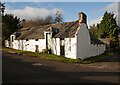
Photos of Maryburgh


Area Information
Maryburgh is a built-up area covering 47.1 hectares on the Scottish mainland. Living in this compact community offers a distinct sense of place that differs from larger urban centres. The area functions as a focused settlement where daily life revolves around local facilities and nearby transport links. Residents of Maryburgh find themselves situated within a practical reach of Conon Bridge, Dingwall, and Muir of Ord. This location defines the rhythm of daily routines for those calling this home. The area's small footprint influences the pace of life compared to sprawling cities. You experience a community environment where neighbours and local services are inherently close. This layout is suitable for those who value proximity over extensive amenities. Homes in Maryburgh provide a straightforward addressing of spatial needs without the complication of vast internal distances. The character of the settlement remains defined by its physical boundaries and immediate surroundings. Prospective buyers should understand that the location is embedded within the wider Inverness-shire geography. Access to rail services nearby connects you to broader travel networks without requiring a long journey to reach the station. The specific classification as a built-up area indicates a density that supports local interaction. Living here means accepting the constraints and advantages inherent to a town centre of this specific scale. It is an arrangement that prioritises direct access to immediate neighbourhood resources.
- Area Type
- Built Up Area 250
- Area Size
- 47.1 hectares
- Population
- Not available
- Population Density
- Not available
Residents of Maryburgh benefit from several retail and transport amenities within practical reach. The local shopping environment includes a Spar, a Co-op Conon, and another Spar, providing five notable high-street retailers. These five shops constitute the primary retail offering for those living in the area. You can access groceries and daily necessities through these specific named venues without extensive travel. Rail connectivity complements the local shopping options with three nearby railway stations. Conon Bridge Railway Station sits closest to the area, while Dingwall Railway Station and Muir of Ord Railway Station are accessible for longer journeys. These three stations ensure you have multiple points of departure for rail travel. This variety in rail access supports both local commuting and wider regional travel. The limited range of amenities reflects the area's compact 47.1-hectare size. Living in Maryburgh means your lifestyle centres on these five specific retail outlets and the three rail links. There are no recorded data on parks, leisure facilities, or dining options beyond the basic retail sector. Your daily convenience relies heavily on the presence of the Co-op Conon and the two Spar stores. The transport network of three stations provides the main avenue for accessing services outside the immediate neighbourhood.
Amenities
Schools
| Rank | School | Type | Entry gender | Ages |
|---|
Explore more schools in this area
Go to Schools tabDemographics
The demographic profile of Maryburgh reflects the composition of a specific type of Scottish settlement. Current data does not include detailed age distributions, household sizes, or ethnicity breakdowns for this particular area. Without these specific statistics, we cannot construct a precise picture of the community's age profile or diversity levels. The absence of recorded figures prevents any statement on whether the population skews towards families or older residents. Home ownership rates and accommodation type breakdowns are similarly unavailable for Maryburgh in the current dataset. You cannot determine the percentage of residents who own their homes versus those renting privately or through social housing. This lack of information limits the ability to describe the typical household structure or tenure mix. Deprivation indices, which often inform quality of life discussions, are not present for this location. Consequently, any inference about economic standing would be purely speculative and unsupported by evidence. When assessing demographics for Maryburgh, you must acknowledge the limits of the available information. There are no records of specific population counts or density metrics that define who lives here today. The data simply does not support a detailed demographic narrative for this built-up area. Any description of the community must rely on the known physical characteristics of the area rather than resident statistics. This gap in data means that claims about household types or ownership levels remain unverified for Maryburgh.
Household Size
Accommodation Type
Tenure
Ethnic Group
Religion
Household Composition
Age
Household Deprivation
NS-SEC
Explore more demographic insights in this area
Go to Demographics tabPlanning
Planning Constraints
- Crime RiskPremium