Area Overview for IV6 7UL
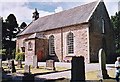
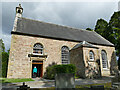
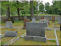
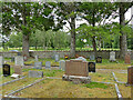
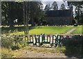
Photos of IV6 7UL


Area Information
Living in IV6 7UL means residing within a specific postcode area covering a small residential cluster in Scotland. This pocket of the northern landscape spans 8.3 km², offering a defined space for those seeking a localised community. The area is physically compact, which often translates to a sense of intimacy rather than the sprawl found in larger urban zones. You will find yourself in a setting that prioritises direct access to immediate surroundings over distant city centres. Daily life here revolves around the practicalities of a smaller, contained environment where neighbours are often within sight of one another. The character of IV6 7UL is shaped by its proximity to key rail links. Rail stations such as Muir of Ord, Conon Bridge, and Beauly are within practical reach, defining the rhythm of movement for residents. Retail choices are similarly accessible, with shops like the Co-op Muir of and Spar located nearby. This layout supports a lifestyle where most essential needs can be met without extensive travel. You live in a zone where the distance between home and these services remains short, fostering a routine built on convenience. The area does not shout for attention like a major town, but it functions efficiently for those who value a straightforward, neighbourhood-focused existence.
- Area Type
- Postcode
- Area Size
- 8.3 km²
- Population
- Not available
- Population Density
- Not available
The property market in IV6 7UL operates within the context of a small residential cluster in Scotland. You will encounter homes in an area that is both geographically and demographically contained. Accommodation types vary across the 8.3 km² span, presenting options that cater to different family sizes and preferences. The mix likely includes flats, as well as larger detached or semi-detached properties common in Scottish residential areas. Home ownership levels are not specified in the current data, but buyers can expect a varied stock. This range means you can find properties suitable for first-time purchasers, families requiring several bedrooms, or those seeking a change of pace from urban living. The market here is distinct from larger towns due to the limited supply caused by the area's small size. Prices often reflect the balance between scarcity and access to local rail hubs. For those considering homes in IV6 7UL, the property types available offer direct links to nearby transport and retail. You do not need to look far for a balance between residential comfort and functional access. The housing stock serves the practical needs of residents who rely on the proximity of stations like Conon Bridge and Muir of Ord. This makes the property market particularly attractive to commuters who value function alongside location.
House Prices in IV6 7UL
Showing 87 properties
| Address | Type | Beds | Baths | Last Sale Price | Last Sale Date | |
|---|---|---|---|---|---|---|
| 2, Park Cottage, Highfield Urray Church, Highfield, Muir Of Ord, IV6 7UL | Semi-detached | 3 | 1 | - | - | |
| Arcan Croft, South Arcan Road, Arcan, Muir Of Ord, IV6 7UL | Detached | 5 | 2 | - | - | |
| Birch Grove, South Arcan Road, Arcan, Muir Of Ord, IV6 7UL | Detached | 4 | 2 | - | - | |
| Carndaisy House, Easter Urray, Highfield Urray Church, Highfield, Muir Of Ord, IV6 7UL | Bungalow | 7 | 7 | - | - | |
| Cladamry, South Arcan Road, Arcan, Muir Of Ord, IV6 7UL | Bungalow | 4 | 2 | - | - | |
| Kylerea, Balvraid Road, Wester Urray, Muir Of Ord, IV6 7UL | Bungalow | 4 | 2 | - | - | |
| Merlewood, Easter Urray, Highfield Urray Church, Highfield, Muir Of Ord, IV6 7UL | Retail | 3 | 3 | - | - | |
| Orrindale, Balvraid Road, Wester Urray, Muir Of Ord, IV6 7UL | Retail | 3 | 1 | - | - | |
| Woodview, Highfield, Muir Of Ord, IV6 7UL | Detached | 4 | 2 | - | - | |
| Tor House, A 832 West Road Muir Of Ord Junction Arcan Mains, Muir Of Ord, IV6 7UL | Detached | 4 | 2 | - | - |
Energy Efficiency in IV6 7UL
Your daily life in IV6 7UL is shaped by the specific amenities located within the 8.3 km² area and its immediate surroundings. Retail options are practical and locally focused. You can shop at the Co-op Muir of, the Spar, and the Co-op Conon. These stores are not just points of sale but central locations for gathering supplies and meeting neighbours. They serve the core needs of the residential cluster without requiring a trip to a distant town centre. Rail transport plays a significant role in your broader lifestyle. You have four nearby rail stations to choose from, including Muir of Ord Railway Station, Conon Bridge Railway Station, and Beauly Railway Station. These stations offer a direct link to wider networks, allowing you to access jobs or services outside the immediate area conveniently. The combination of local shops and regional trains creates a functional routine. You do not need to drive for everything, though the area feels best when you can walk to the Co-op or catch a train when weather permits. This lifestyle suits those who appreciate self-sufficiency. The presence of these specific venues ensures that you never lack for basic conveniences. The area is defined by this practical integration of retail and transport, making it a viable place to live for people who need reliable access to goods and travel links.
Amenities
Schools
| Rank | School | Type | Entry gender | Ages |
|---|
Explore more schools in this area
Go to Schools tabDemographics
The community in IV6 7UL is composed of residents who inhabit this small residential cluster. While exact population figures are not provided in the current overview, the area is characterised by its tight-knit nature due to its size. The 8.3 km² footprint suggests a population density that encourages interaction between neighbours. Household types, age profiles, and diversity levels are not detailed in the available statistics, but the physical constraints of the area often influence how people choose to live here. In many small Scottish postcodes, you will frequently find a mix of long-term families occupying larger properties and younger professionals opting for smaller homes. Without specific data on deprivation or home ownership percentages for IV6 7UL, understanding the demographic mix relies on observing the housing landscape surrounding the postcode. The area likely hosts a range of home ownership levels, though specific figures are absent from the current profile. Residents here share a common trait: living in a defined space where the scale of the environment keeps the community relatively manageable. This setup supports a lifestyle where local events and neighbourly relations can flourish despite the lack of large-scale census data for this specific cluster.
Household Size
Accommodation Type
Tenure
Ethnic Group
Religion
Household Composition
Age
Household Deprivation
NS-SEC
Explore more demographic insights in this area
Go to Demographics tabPlanning
Planning Constraints
- Flood RiskPremium
- Ramsar Wetland SitesPremium
- Area of Outstanding Natural BeautyPremium
- Protected Nature ReservePremium
- Protected WoodlandPremium
- Crime RiskPremium