Area Overview for IV51 9QF
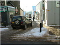
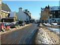
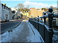
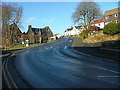
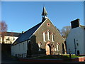
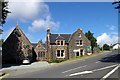
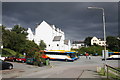
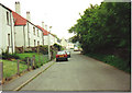
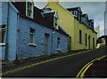
Photos of IV51 9QF


Area Information
IV51 9QF is a small residential postcode cluster in Scotland, positioned near key coastal infrastructure. Its compact size suggests a tight-knit community, with residents likely relying on nearby services and transport links. The area’s proximity to Portree Ferry Terminal and Raasay Ferry Terminal offers direct access to island travel, which is crucial for both daily commutes and leisure. While the broadband score is poor (29/100), mobile coverage is relatively good (75/100), supporting basic connectivity for residents. Daily life here is shaped by proximity to natural landscapes and limited local amenities, with Co-op Portree serving as a primary retail hub. The area’s small footprint means it is likely surrounded by open countryside or coastal scenery, though specific details about local geography are not provided. For buyers, IV51 9QF may appeal to those prioritising rural living with access to ferry routes, though the digital infrastructure may require consideration for remote work or high-bandwidth needs.
- Area Type
- Postcode
- Area Size
- Not available
- Population
- Not available
- Population Density
- Not available
House Prices in IV51 9QF
No properties found in this postcode.
Energy Efficiency in IV51 9QF
Living in IV51 9QF offers access to essential retail and transport services within close proximity. The Co-op Portree is a notable local shop, providing basic grocery and household needs. For residents seeking broader connectivity, the Portree Ferry Terminal and Raasay Ferry Terminal are key assets, offering regular services to nearby islands. These terminals likely serve as focal points for both daily travel and weekend excursions. While the area’s small size means limited dining or leisure options, the ferry access opens up opportunities to explore coastal towns and natural attractions beyond the immediate postcode. The presence of two ferry terminals suggests a community that values mobility and access to island life, though the lack of detailed data on local parks or recreational spaces means the area’s green spaces remain unspecified. Overall, IV51 9QF appears to cater to those prioritising coastal convenience over urban amenities.
Amenities
Schools
| Rank | School | Type | Entry gender | Ages |
|---|
Explore more schools in this area
Go to Schools tabDemographics
Household Size
Accommodation Type
Tenure
Ethnic Group
Religion
Household Composition
Age
Household Deprivation
NS-SEC
Explore more demographic insights in this area
Go to Demographics tabPlanning
Planning Constraints
- Flood RiskPremium
- Ramsar Wetland SitesPremium
- Area of Outstanding Natural BeautyPremium
- Protected Nature ReservePremium
- Protected WoodlandPremium
- Crime RiskPremium