Area Overview for IV51 9JS
Photos of IV51 9JS
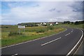
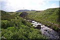
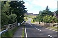
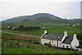
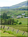

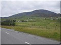
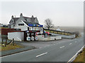
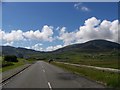
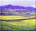
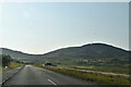
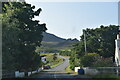
13 photos from this area
Area Information
Key information about the IV51 9JS including its size, population, and administrative classification.
- Area Type
- Postcode
- Area Size
- 3.3 km²
- Population
- Not available
- Population Density
- Not available
House Prices in IV51 9JS
56
Properties
-
Average Sold Price
-
Lowest Price
-
Highest Price
Showing 56 properties
| Address | Type | Beds | Baths | Last Sale Price | Last Sale Date | |
|---|---|---|---|---|---|---|
| Rowanlea, Garafad Road, Staffin, IV51 9JS | Detached | 3 | 1 | - | - | |
| Seadrift, Stenscholl, Staffin Boatslip Road, Staffin, IV51 9JS | Bungalow | 4 | 4 | - | - | |
| 5, Achtalean, Stenscholl, Staffin Boatslip Road, Staffin, IV51 9JS | Detached | 5 | 4 | - | - | |
| 3, Fir Tree Cottage, Stenscholl, A 855 Digg Road Junction Staffin Boatslip Road Junction, Staffin, IV51 9JS | Bungalow | 3 | 1 | - | - | |
| 25, Stenscholl, Staffin Boatslip Road, Staffin, IV51 9JS | Detached | 2 | 1 | - | - | |
| 8, Former, Stenscholl, Staffin Boatslip Road, Staffin, IV51 9JS | Detached | - | - | - | - | |
| 3, Staffin Bay Holiday Homes Historic, Staffin Boatslip Road, Staffin, IV51 9JS | Semi-detached | - | - | - | - | |
| The Hungry Gull, Cafe And Takeaway, Garafad Road, Staffin, IV51 9JS | Restaurant | - | - | - | - | |
| Staffin Community Trust, Staffin Harbour Office, Staffin Boatslip Road, Staffin, IV51 9JS | Office | - | - | - | - | |
| 11, Ben Edra, Stenscholl, Staffin Boatslip Road, Staffin, IV51 9JS | Bungalow | - | - | - | - |
Page 1 of 6
Energy Efficiency in IV51 9JS
Amenities
Schools
| Rank | School | Type | Entry gender | Ages |
|---|
Explore more schools in this area
Go to Schools tabDemographics
Household Size
N/A
most common
Accommodation Type
N/A
most common
Tenure
N/A
majority
Ethnic Group
N/A
most common
Religion
N/A
most common
Household Composition
N/A
most common
Age
N/A
median
N/A
most common
Household Deprivation
N/A
with no deprivation
NS-SEC
N/A
in Lower managerial occupations
Explore more demographic insights in this area
Go to Demographics tabPlanning
Planning Constraints
- Flood RiskPremium
- Ramsar Wetland SitesPremium
- Area of Outstanding Natural BeautyPremium
- Protected WoodlandPremium
- Crime RiskPremium