Area Overview for IV51 9BU
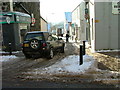
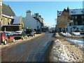
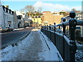
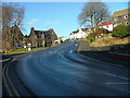
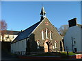
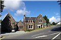
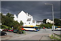
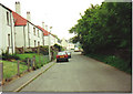
Photos of IV51 9BU


Area Information
IV51 9BU is a small residential cluster in Scotland, covering 1,670 square metres. This postcode area is compact, with a focus on practical living and easy access to essential services. Residents benefit from proximity to two Co-op stores in Portree, ensuring daily shopping needs are met. The area is also well-connected to ferry terminals at Portree and Raasay, offering direct links to nearby islands. While the population figures are not explicitly stated, the small size of the area suggests a close-knit community. The low flood risk and absence of protected natural sites like AONB or Ramsar wetlands indicate a relatively low environmental constraint, making it a stable place to live. Daily life here is likely characterised by a balance between local amenities and the natural surroundings, with a focus on accessibility and simplicity. The area’s size means it is not densely populated, offering a quiet, manageable environment for those seeking a slower pace of life.
- Area Type
- Postcode
- Area Size
- 1670 m²
- Population
- Not available
- Population Density
- Not available
House Prices in IV51 9BU
Showing 2 properties
| Address | Type | Beds | Baths | Last Sale Price | Last Sale Date | |
|---|---|---|---|---|---|---|
| Royal Hotel Residential Accommodation Historic, Bank Street, Portree, IV51 9BU | undefined | - | - | - | - | |
| The Royal Hotel, Royal Hotel, Bank Street, Portree, IV51 9BU | hotel | - | - | - | - |
Energy Efficiency in IV51 9BU
Residents of IV51 9BU have access to two Co-op stores in Portree, providing essential retail and grocery services within practical reach. These stores likely serve as community hubs, offering not only shopping but also a sense of local identity. The area’s ferry terminals at Portree and Raasay connect residents to nearby islands, enabling travel for leisure, work, or commuting. While the data does not specify dining or leisure options, the presence of ferry services suggests a lifestyle centred around maritime access and island exploration. The small area size means amenities are concentrated, making daily errands efficient. The lack of detailed information on parks or recreational spaces implies that natural surroundings may play a significant role in leisure activities, though this is not explicitly confirmed by the data.
Amenities
Schools
| Rank | School | Type | Entry gender | Ages |
|---|
Explore more schools in this area
Go to Schools tabDemographics
Household Size
Accommodation Type
Tenure
Ethnic Group
Religion
Household Composition
Age
Household Deprivation
NS-SEC
Explore more demographic insights in this area
Go to Demographics tabPlanning
Planning Constraints
- Flood RiskPremium
- Ramsar Wetland SitesPremium
- Area of Outstanding Natural BeautyPremium
- Protected Nature ReservePremium
- Protected WoodlandPremium
- Crime RiskPremium