Area Overview for IV40 8BD
Photos of IV40 8BD
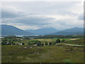
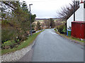
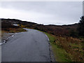
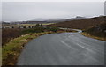
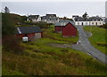
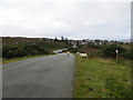
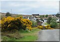
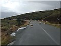
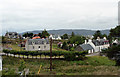
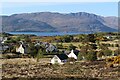
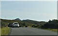
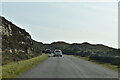
16 photos from this area
Area Information
Key information about the IV40 8BD including its size, population, and administrative classification.
- Area Type
- Postcode
- Area Size
- 2.5 km²
- Population
- Not available
- Population Density
- Not available
House Prices in IV40 8BD
30
Properties
-
Average Sold Price
-
Lowest Price
-
Highest Price
Showing 30 properties
| Address | Type | Beds | Baths | Last Sale Price | Last Sale Date | |
|---|---|---|---|---|---|---|
| Creagan Cottage, 111 Creagan Brae, Drumbuie, IV40 8BD | Detached | 4 | 1 | - | - | |
| Ravenswood, Coulgorm, Drumbuie, IV40 8BD | Detached | 4 | 2 | - | - | |
| Windy Ridge, Main Street, Drumbuie, IV40 8BD | Cottage | 2 | 1 | - | - | |
| Struan Lea, 268 Main Street, Drumbuie, IV40 8BD | house | 3 | - | - | - | |
| Carrachan, Creagan Brae, Drumbuie, IV40 8BD | Detached | - | - | - | - | |
| Tulach Ard, Coulgorm, Drumbuie, IV40 8BD | Detached | - | - | - | - | |
| Port Cam, 108 Coulgorm, Drumbuie, IV40 8BD | house | - | - | - | - | |
| Nanyuki, Coulgorm, Drumbuie, IV40 8BD | house | - | - | - | - | |
| Croft Cottage, Creagan Brae, Drumbuie, IV40 8BD | Detached | - | - | - | - | |
| Bealach View, Main Street, Drumbuie, IV40 8BD | Detached | - | - | - | - |
Page 1 of 3
Energy Efficiency in IV40 8BD
Amenities
Schools
| Rank | School | Type | Entry gender | Ages |
|---|
Explore more schools in this area
Go to Schools tabDemographics
Household Size
N/A
most common
Accommodation Type
N/A
most common
Tenure
N/A
majority
Ethnic Group
N/A
most common
Religion
N/A
most common
Household Composition
N/A
most common
Age
N/A
median
N/A
most common
Household Deprivation
N/A
with no deprivation
NS-SEC
N/A
in Lower managerial occupations
Explore more demographic insights in this area
Go to Demographics tabPlanning
Planning Constraints
- Flood RiskPremium
- Ramsar Wetland SitesPremium
- Area of Outstanding Natural BeautyPremium
- Protected WoodlandPremium
- Crime RiskPremium