Area Overview for IV20 1XW
Photos of IV20 1XW
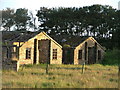
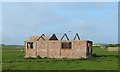

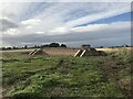
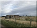
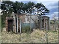
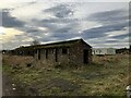
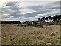


13 photos from this area
Area Information
Key information about the IV20 1XW including its size, population, and administrative classification.
- Area Type
- Postcode
- Area Size
- 3.8 km²
- Population
- Not available
- Population Density
- Not available
House Prices in IV20 1XW
29
Properties
-
Average Sold Price
-
Lowest Price
-
Highest Price
Showing 29 properties
| Address | Type | Beds | Baths | Last Sale Price | Last Sale Date | |
|---|---|---|---|---|---|---|
| 1, Loans Of Fearn Steading, Loans Of Tullich, Fearn, IV20 1XW | Detached | 4 | 3 | - | - | |
| Tullich Brae, B 9166 B 9165 Junction Balintore, Fearn, IV20 1XW | Bungalow | 3 | 2 | - | - | |
| Westwinds, Ashfield, Loans Of Tullich, Fearn, IV20 1XW | Detached | 4 | 2 | - | - | |
| The Sycamores, B 9166 B 9165 Junction Balintore, Fearn, IV20 1XW | Detached | 3 | 2 | - | - | |
| OLD WELDEX YARD CARAVAN, FEARN AERODROME, B 9166 B 9165 JUNCTION BALINTORE, Fearn, IV20 1XW | Mobile Home | - | - | - | - | |
| Elska Tir, Loans Of Tullich, Fearn, IV20 1XW | Detached | - | - | - | - | |
| Warehouse 8, Fearn Warehousing Complex, B 9166 B 9165 Junction Balintore, Fearn, IV20 1XW | warehouse | - | - | - | - | |
| Caravan, The Last Post, Loans Of Tullich, Fearn, IV20 1XW | Mobile Home | - | - | - | - | |
| Elska Tir Caravan, Loans Of Tullich, Fearn, IV20 1XW | Mobile Home | - | - | - | - | |
| Rose Cottage, Loans Of Tullich, Fearn, IV20 1XW | Detached | - | - | - | - |
Page 1 of 3
Energy Efficiency in IV20 1XW
Amenities
Schools
| Rank | School | Type | Entry gender | Ages |
|---|
Explore more schools in this area
Go to Schools tabDemographics
Household Size
N/A
most common
Accommodation Type
N/A
most common
Tenure
N/A
majority
Ethnic Group
N/A
most common
Religion
N/A
most common
Household Composition
N/A
most common
Age
N/A
median
N/A
most common
Household Deprivation
N/A
with no deprivation
NS-SEC
N/A
in Lower managerial occupations
Explore more demographic insights in this area
Go to Demographics tabPlanning
Planning Constraints
- Flood RiskPremium
- Ramsar Wetland SitesPremium
- Area of Outstanding Natural BeautyPremium
- Protected Nature ReservePremium
- Protected WoodlandPremium
- Crime RiskPremium