Area Overview for IV18 0JR
Photos of IV18 0JR


Area Information
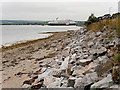
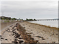
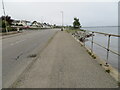
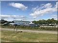
IV18 0JR is a small residential postcode cluster in Scotland, covering just 9,884 square metres. This compact area is positioned near key transport links, including Invergordon and Alness railway stations, and within reach of multiple ferry terminals like Invergordon Port and Nigg. Its proximity to these connections makes it a practical choice for commuters and those who value accessibility. The area’s low flood risk and absence of major environmental constraints, such as AONB or Ramsar sites, suggest a stable, low-maintenance living environment. While the population size isn’t specified, the area’s size and amenities hint at a tight-knit community. Daily life here balances practicality with scenic surroundings, with nearby retail options like Co-op Invergordon and Lidl Alness offering convenience. The presence of protected woodland adds a touch of natural beauty, though it may influence planning restrictions. For buyers seeking a quiet, functional postcode with strong connectivity, IV18 0JR presents a focused opportunity.
- Area Type
- Postcode
- Area Size
- 9884 m²
- Population
- Not available
- Population Density
- Not available
House Prices in IV18 0JR
Showing 1 properties
| Address | Type | Beds | Baths | Last Sale Price | Last Sale Date | |
|---|---|---|---|---|---|---|
| County Hospital, B 817 Cromarty View Invergordon Barbaraville, Invergordon, IV18 0JR | Office | - | - | - | - |
Energy Efficiency in IV18 0JR
Living in IV18 0JR offers access to a range of local amenities within practical reach. Retail options include Co-op Invergordon, Farmfoods Invergordon, and Lidl Alness, providing essentials and everyday shopping convenience. The area’s ferry terminals—Invergordon Port, Cromarty, and Nigg—open up travel possibilities, whether for leisure or commuting. Rail access via Invergordon and Alness stations connects residents to broader networks. While specific parks or leisure facilities aren’t detailed in the data, the presence of protected woodland suggests nearby green spaces. The combination of retail, transport, and natural elements creates a functional lifestyle, ideal for those valuing accessibility and practicality. For families or professionals, the area’s amenities support daily routines without requiring lengthy trips. The small postcode size means services are closely grouped, enhancing convenience for residents.
Amenities
Schools
| Rank | School | Type | Entry gender | Ages |
|---|
Explore more schools in this area
Go to Schools tabDemographics
Household Size
Accommodation Type
Tenure
Ethnic Group
Religion
Household Composition
Age
Household Deprivation
NS-SEC
Explore more demographic insights in this area
Go to Demographics tabPlanning
Planning Constraints
- Flood RiskPremium
- Ramsar Wetland SitesPremium
- Area of Outstanding Natural BeautyPremium
- Protected Nature ReservePremium
- Protected WoodlandPremium
- Crime RiskPremium