Area Overview for IV15 9JF
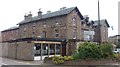
Photos of IV15 9JF


Area Information
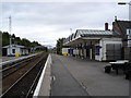
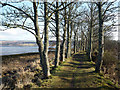
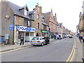
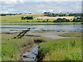
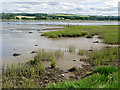
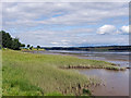
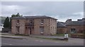
IV15 9JF is a small residential postcode cluster in Scotland, offering a quiet, low-density living environment. The area is defined by its compact size and proximity to key transport hubs, including three nearby railway stations: Dingwall, Conon Bridge, and Muir of Ord. These stations provide regular connections to larger towns and cities, making commuting or travel straightforward. The postcode is served by a modest range of retail amenities, including Lidl Dingwall, Spar, and Tesco Dingwall, which cater to daily needs without requiring long journeys. While the area’s small footprint means it is not a commercial or industrial hub, it offers a peaceful, community-focused lifestyle. Residents here likely value convenience, with local shops and transport within walking or cycling distance. The absence of major planning constraints, such as protected woodlands or areas of outstanding natural beauty, suggests a straightforward development environment. For those seeking a tranquil, accessible location with practical amenities, IV15 9JF presents a viable option.
- Area Type
- Postcode
- Area Size
- Not available
- Population
- Not available
- Population Density
- Not available
House Prices in IV15 9JF
No properties found in this postcode.
Energy Efficiency in IV15 9JF
Living in IV15 9JF offers access to a selection of essential retail amenities within practical reach. Local shops such as Lidl Dingwall, Spar, and Tesco Dingwall provide grocery and convenience services, reducing the need for long trips to larger towns. While the area does not feature prominent parks or leisure facilities, its proximity to rail stations may grant access to nearby recreational spaces. The presence of three railway stations also enhances connectivity to cultural and commercial hubs further afield. For residents prioritising convenience and accessibility, the combination of local retail and transport links creates a functional, low-maintenance lifestyle. However, the absence of detailed information on dining or leisure options means the area’s character beyond retail and transport remains less defined.
Amenities
Schools
| Rank | School | Type | Entry gender | Ages |
|---|
Explore more schools in this area
Go to Schools tabDemographics
Household Size
Accommodation Type
Tenure
Ethnic Group
Religion
Household Composition
Age
Household Deprivation
NS-SEC
Explore more demographic insights in this area
Go to Demographics tabPlanning
Planning Constraints
- Flood RiskPremium
- Ramsar Wetland SitesPremium
- Area of Outstanding Natural BeautyPremium
- Protected Nature ReservePremium
- Protected WoodlandPremium
- Crime RiskPremium