Area Overview for IV15 9HJ
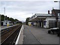
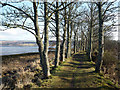
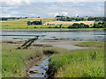
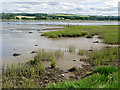
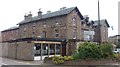
Photos of IV15 9HJ


Area Information
IV15 9HJ is a small, tightly defined postcode area in Scotland, covering just 626 square metres. It forms part of a compact residential cluster, likely centred around local amenities and community hubs. While the area’s size suggests a close-knit environment, it is positioned near key transport links, including three railway stations: Dingwall, Conon Bridge, and Muir of Ord. These stations connect residents to broader regional networks, making commuting or travel relatively straightforward. The area’s proximity to retail options such as Lidl Dingwall, Spar, and Tesco Dingwall ensures daily essentials are within easy reach. This blend of accessibility and compactness may appeal to those seeking a quiet, self-contained living environment without sacrificing convenience. The area’s character is likely shaped by its rural or semi-rural setting, with limited exposure to urban sprawl. However, the absence of specific data on population or historical context means the community’s full profile remains to be explored. For now, IV15 9HJ appears to balance simplicity with practicality, offering a foundation for a lifestyle that prioritises ease of access over sprawling infrastructure.
- Area Type
- Postcode
- Area Size
- 626 m²
- Population
- Not available
- Population Density
- Not available
House Prices in IV15 9HJ
Showing 1 properties
| Address | Type | Beds | Baths | Last Sale Price | Last Sale Date | |
|---|---|---|---|---|---|---|
| Middleton Ross And Arnot, Mansefield House, 7 High Street, Dingwall, IV15 9HJ | office_workshop | - | - | - | - |
Energy Efficiency in IV15 9HJ
The lifestyle in IV15 9HJ is shaped by its proximity to essential retail and transport hubs. Local supermarkets like Lidl Dingwall, Spar, and Tesco Dingwall provide a range of groceries, convenience items, and daily necessities, reducing the need for long trips to larger centres. For residents who enjoy a mix of retail and community spaces, these stores likely serve as informal meeting points. The three nearby railway stations also contribute to the area’s accessibility, enabling easy travel to nearby towns for leisure, shopping, or employment. While the data does not specify parks or leisure facilities, the absence of protected natural areas or planning constraints suggests a relatively open environment. The compact nature of the area may foster a sense of familiarity and ease, with amenities clustered closely together. However, the lack of detailed information on recreational spaces means the full extent of lifestyle options remains to be explored.
Amenities
Schools
| Rank | School | Type | Entry gender | Ages |
|---|
Explore more schools in this area
Go to Schools tabDemographics
Household Size
Accommodation Type
Tenure
Ethnic Group
Religion
Household Composition
Age
Household Deprivation
NS-SEC
Explore more demographic insights in this area
Go to Demographics tabPlanning
Planning Constraints
- Flood RiskPremium
- Ramsar Wetland SitesPremium
- Area of Outstanding Natural BeautyPremium
- Protected Nature ReservePremium
- Protected WoodlandPremium
- Crime RiskPremium