Area Overview for IV15 9HG
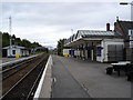
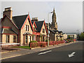
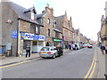
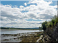
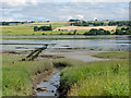
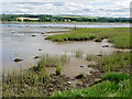
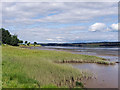
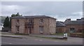
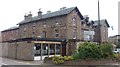
Photos of IV15 9HG


Area Information
IV15 9HG is a small residential postcode in Scotland, encompassing a compact cluster of homes within 906 square metres. This area is characterised by its proximity to key transport links, with three railway stations—Dingwall, Conon Bridge, and Muir of Ord—within practical reach. The community benefits from a mix of retail options, including Lidl Dingwall, Spar, and Tesco Dingwall, offering everyday convenience. While the area is small, its strategic location provides access to nearby towns and services. The postcode is ideal for those seeking a quiet, low-risk environment with reliable rail connections. With no protected natural sites or flood risks, it offers a stable foundation for living. The area’s modest size means it is likely to be a close-knit community, though specific details about its cultural or social fabric are not provided in the data.
- Area Type
- Postcode
- Area Size
- 906 m²
- Population
- Not available
- Population Density
- Not available
House Prices in IV15 9HG
No properties found in this postcode.
Energy Efficiency in IV15 9HG
Daily life in IV15 9HG is supported by nearby amenities, including five retail outlets such as Lidl Dingwall, Spar, and Tesco Dingwall. These stores provide essential shopping options, from groceries to convenience items. The proximity to three railway stations—Dingwall, Conon Bridge, and Muir of Ord—enhances accessibility to broader services, whether for work, leisure, or socialising. While the data does not specify parks or leisure facilities, the absence of protected natural sites or flood risks suggests the area is free from environmental constraints that might limit outdoor activities. The practical reach of amenities means residents can meet most daily needs without long commutes. The combination of retail convenience and rail connectivity positions IV15 9HG as a functional, if modest, base for both local living and regional travel.
Amenities
Schools
| Rank | School | Type | Entry gender | Ages |
|---|
Explore more schools in this area
Go to Schools tabDemographics
Household Size
Accommodation Type
Tenure
Ethnic Group
Religion
Household Composition
Age
Household Deprivation
NS-SEC
Explore more demographic insights in this area
Go to Demographics tabPlanning
Planning Constraints
- Flood RiskPremium
- Ramsar Wetland SitesPremium
- Area of Outstanding Natural BeautyPremium
- Protected Nature ReservePremium
- Protected WoodlandPremium
- Crime RiskPremium