Area Overview for IV14 9ES
Photos of IV14 9ES
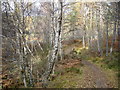
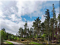
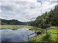

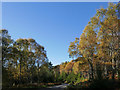
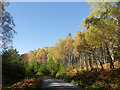
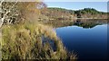
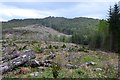
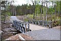
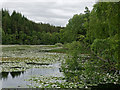
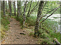
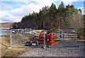
19 photos from this area
Area Information
Key information about the IV14 9ES including its size, population, and administrative classification.
- Area Type
- Postcode
- Area Size
- 8.9 km²
- Population
- Not available
- Population Density
- Not available
House Prices in IV14 9ES
85
Properties
-
Average Sold Price
-
Lowest Price
-
Highest Price
Showing 85 properties
| Address | Type | Beds | Baths | Last Sale Price | Last Sale Date | |
|---|---|---|---|---|---|---|
| Blackwater Lodge, A 835 T Glascarnoch River Bridge A 834 Junction, Contin, IV14 9ES | Detached | 5 | 5 | - | - | |
| Hillview, Munro Park, Contin, IV14 9ES | Bungalow | 3 | 1 | - | - | |
| 2 Watersedge, A 835 T Glascarnoch River Bridge A 834 Junction, Contin, IV14 9ES | Detached | 3 | 2 | - | - | |
| Homewood, A 835 T Glascarnoch River Bridge A 834 Junction, Contin, IV14 9ES | Detached | 4 | 1 | - | - | |
| Torridon, Tor View, Contin, IV14 9ES | Bungalow | 3 | 2 | - | - | |
| Smithy Croft, Coul Mains Drive, Contin, IV14 9ES | Bungalow | 4 | 2 | - | - | |
| Oakview, A 835 T Glascarnoch River Bridge A 834 Junction, Contin, IV14 9ES | Terraced | 4 | 2 | - | - | |
| The Brambles, A 835 T Glascarnoch River Bridge A 834 Junction, Contin, IV14 9ES | Detached | 3 | 3 | - | - | |
| Contin Mains, A 835 T A 834 Junction Wester Moy, Contin, IV14 9ES | Retail | - | - | - | - | |
| Roselea, A 835 T Glascarnoch River Bridge A 834 Junction, Contin, IV14 9ES | Terraced | 2 | 2 | - | - |
Page 1 of 9
Energy Efficiency in IV14 9ES
Amenities
Schools
| Rank | School | Type | Entry gender | Ages |
|---|
Explore more schools in this area
Go to Schools tabDemographics
Household Size
N/A
most common
Accommodation Type
N/A
most common
Tenure
N/A
majority
Ethnic Group
N/A
most common
Religion
N/A
most common
Household Composition
N/A
most common
Age
N/A
median
N/A
most common
Household Deprivation
N/A
with no deprivation
NS-SEC
N/A
in Lower managerial occupations
Explore more demographic insights in this area
Go to Demographics tabPlanning
Planning Constraints
- Flood RiskPremium
- Ramsar Wetland SitesPremium
- Area of Outstanding Natural BeautyPremium
- Protected Nature ReservePremium
- Protected WoodlandPremium
- Crime RiskPremium