Area Overview for Port Glasgow
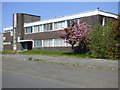
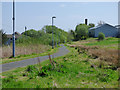
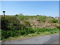
Photos of Port Glasgow


Area Information
Port Glasgow functions as a distinct built-up area within Scotland, covering a total space of 4.3 square kilometres. As a compact town, the geography is defined by high density rather than sprawling suburbs. You will find that daily life here revolves around a centralised community layout where most essentials are within walking distance. The area represents a straightforward choice for those seeking a defined living environment without the commute times associated with larger cities. Residents benefit from a location that integrates seamlessly with nearby transport hubs and retail zones. The town identity is strong, driven by its proximity to industrial history and its connection to the broader Clydebank region. Living in Port Glasgow means accessing a specific character that differs from the open countryside just beyond the town limits. The scale ensures that you can easily navigate the streets without getting lost in unfamiliar territories. This compact nature makes it particularly suitable for individuals who prioritise convenience and a clear sense of place.
- Area Type
- Built Up Area 250
- Area Size
- 4.3 km²
- Population
- Not available
- Population Density
- Not available
Your daily routine in Port Glasgow benefits from a range of amenities located within practical walking distance. Five retail outlets serve the immediate area, anchored by well-known supermarkets such as Lidl Port, Farmfoods Port, and Iceland Port. These venues ensure you can stock your home with groceries and essentials without requiring a long drive. Shopping is convenient, and the presence of multiple stores provides variety in pricing and product range. Transport links further enhance your lifestyle opportunities through five active railway stations and two ferry terminals. The Port Glasgow Railway Station stands as a central hub, while Woodhall and Bogston stations offer additional access points. Two ferry services depart from the Greenock Custom House Quay Ferry Terminal, connecting you directly to Greenock. This network of five train stops and two ferry points means that local travel and regional excursions are easily managed. You can combine a quick trip to the shops with a scheduled ferry ride for a day out, creating a flexible schedule that fits around work and family commitments.
Amenities
Schools
| Rank | School | Type | Entry gender | Ages |
|---|
Explore more schools in this area
Go to Schools tabDemographics
The community profile of Port Glasgow reflects the typical characteristics of a Scottish built-up area of this size. Specific demographic figures such as age distribution, household composition, and diversity statistics are not included in the available data for this location. Without access to detailed census metrics, it is impossible to present precise percentages regarding home ownership levels or specific accommodation types like flats versus detached houses. Consequently, any discussion on the exact age profile or deprivation indices must acknowledge the current data limitations. While the area is established within Inverclyde, the absence of recorded statistics prevents a numerical breakdown of who currently resides in the homes near Port Railway Station. Potential buyers should understand that detailed demographic files are not currently public for this specific region. This lack of granular information means you cannot rely on specific numbers to gauge the median income or family structures in the immediate neighbourhood.
Household Size
Accommodation Type
Tenure
Ethnic Group
Religion
Household Composition
Age
Household Deprivation
NS-SEC
Explore more demographic insights in this area
Go to Demographics tabPlanning
Planning Constraints
- Crime RiskPremium