Area Overview for PA2 9PW
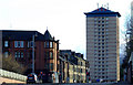
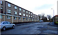
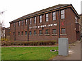
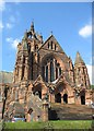
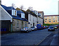
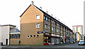
Photos of PA2 9PW


Area Information
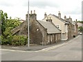
Living in the PA2 9PW postcode offers a specific residential experience defined by its small scale and strategic location within Scotland. This cluster covers just 3,223 square metres, creating an intimate setting where residents are often close to one another. While this is a precise postal code rather than a named suburb, it sits within the broader Paisley region, linking you directly to key transport hubs and commercial centres. Daily life revolves around proximity to major infrastructure, meaning your routine likely includes quick commutes to Glasgow or local employment sites. The area functions as a practical living space rather than a standalone village, relying on the extensive network of services found in neighbouring Paisley. You will find yourself within easy reach of the Paisley Canal Railway Station and Paisley Gilmour Street Railway Station, which anchor your daily travel plans. Tenants and buyers here typically value the balance between a compact living footprint and access to wider amenities. The location is distinct for its digital connectivity and safety profiles, factors that increasingly dictate modern home choices. Prospective buyers should view this postcode as a functional base, ideal for those who prioritise transport links and reliable infrastructure over a large garden or extensive local greenery.
- Area Type
- Postcode
- Area Size
- 3223 m²
- Population
- Not available
- Population Density
- Not available
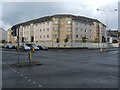
The property market in PA2 9PW is characterised by its status as a small residential cluster with specific housing stock dynamics. This postcode serves primarily as a gateway to larger housing developments in the surrounding Paisley and Greenhill areas. Buyers looking at homes in PA2 9PW should understand that this area likely contains a mix of tenanted flats and terraced houses typical of post-war development in West Renfrewshire. The market here is increasingly influenced by digital connectivity, as high-speed internet is essential for modern households. While specific home ownership percentages for this immediate cluster are not published, the surrounding PA2 postcodes generally reflect a balanced market of both owner-occupied and social housing. You will find fewer detached luxury properties compared to other Paisley sub-areas, meaning value is often derived from location and transport access. The limited size of 3,223 square metres suggests a high-density environment relative to the postal boundary, with properties built to maximise the available land. Investors and first-time buyers dominate interest in such a compact zone, drawn by the proximity to Glasgow International Airport and major rail lines. When searching for properties, expect a competitive market for well-maintained flats and lower-floor units that offer easy access to local amenities like Co-op Paisley and the nearby underground stations.
House Prices in PA2 9PW
Showing 1 properties
| Address | Type | Beds | Baths | Last Sale Price | Last Sale Date | |
|---|---|---|---|---|---|---|
| 17 Corsebar Road, Paisley, PA2 9PW | Detached | - | - | - | - |
Energy Efficiency in PA2 9PW
Living in PA2 9PW places you at the heart of an extensive network of shops, leisure facilities, and transport hubs. Your daily shopping routine can begin at Co-op Paisley, supported by essential stores like Farmfoods Paisley and Spar Greenhill, all located within practical reach. These five retail outlets provide a comprehensive range of groceries and daily necessities without the need for a long journey. Leisure and travel options are equally abundant, with five rail stations, five ferry terminals, five underground stations, and one airport terminal all accessible from your doorstep. Travel to Glasgow can be managed from Ibrox or Govan Underground Stations, while ferry crossings at Renfrew or Yoker offer coastal alternatives. The proximity to Braehead Shopping Centre Ferry Landing connects you not just to transport, but to a major retail destination. While specific parks or gardens are not named in the immediate amenity data for this exact postcode, the density of transport and retail nodes creates a self-contained urban environment. Residents benefit from a lifestyle where work, shopping, and travel coexist within a short walking or cycling distance. The combination of these nineteen distinct infrastructure points ensures that you can access a full range of city services without leaving the local infrastructure zone.
Amenities
Schools
| Rank | School | Type | Entry gender | Ages |
|---|
Explore more schools in this area
Go to Schools tabDemographics
The community profile for PA2 9PW reflects the broader housing market characteristics of its immediate surroundings. Without specific population figures for this exact cluster, the area aligns with patterns seen in similar small residential zones in West Renfrewshire. Residents here typically navigate a mix of private and social housing, although specific ownership percentages for this postcode are not detailed in current records. The local demographic is shaped by the availability of rental stock and family-sized properties in the PA2 region. Education remains a priority for families, with schools near the area serving as key community anchors. While data on the precise age distribution or household types for these exact dimensions is not provided, the location supports a standard mix of households common to working-age adults and families in the Paisley postcode sector. Residents encounter a typical deprivation profile for the region, which influences local spending power and access to certain private services. However, the area is not burdened by significant planning constraints such as protected wetlands or nature reserves, allowing for a more flexible residential environment. You can expect a standard neighbourhood atmosphere without the restrictions imposed by Areas of Outstanding Natural Beauty or Ramsar sites. The population dynamic is driven by commuter trends rather than isolated rural lifestyle preferences.
Household Size
Accommodation Type
Tenure
Ethnic Group
Religion
Household Composition
Age
Household Deprivation
NS-SEC
Explore more demographic insights in this area
Go to Demographics tabPlanning
Planning Constraints
- Flood RiskPremium
- Ramsar Wetland SitesPremium
- Area of Outstanding Natural BeautyPremium
- Protected Nature ReservePremium
- Protected WoodlandPremium
- Crime & SafetyPremium