Area Overview for PA2 8RS
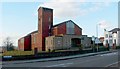
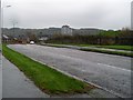
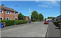
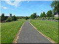
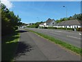
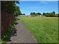
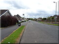
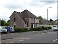
Photos of PA2 8RS


Area Information
Living in PA2 8RS means residing within a specific residential cluster covering 2.7 hectares just outside Glasgow. This postcode area serves as a quiet, compact residential zone that connects directly to the wider City of Paisley and the urban fringe. The location sits at the intersection of established transport networks, offering immediate access to major destinations without the density of the city centre. You will find a community focused on practicality and convenience, where those seeking homes near Braehead Shopping Centre or the local railway stations can commute effortlessly. The area functions as a reliable base for families and professionals working across the Greater Glasgow region. Daily life involves easy access to essential services and leisure facilities located minutes away. The small footprint of the postcode ensures a defined local community feel, yet the connection to broader infrastructure keeps you well-integrated into regional life. Property buyers here often choose PA2 8RS for its balance of suburban tranquillity and urban accessibility. The area avoids the planning constraints of protected landscapes, meaning local development follows standard urban planning rules rather than restrictions found in Areas of Outstanding Natural Beauty. This addresses the needs of those wanting a established neighbourhood with clear boundaries and familiar local characteristics.
- Area Type
- Postcode
- Area Size
- 2.7 hectares
- Population
- Not available
- Population Density
- Not available
Homes in PA2 8RS sit within a networked postcode area that pulls property values from the broader Glasgow and Paisley markets. The 2.7-hectare residential cluster acts as a node connecting buyers to larger property portfolios in the immediate vicinity. You will encounter a balanced mix of property types, including terraced homes, semi-detached houses, and potentially some flats, though the exact dominance of each requires viewing current listings. The area lacks the protective status of an Area of Outstanding Natural Beauty or protected nature reserve, which means property values respond directly to market forces rather than being artificially supported by scenic restrictions. As a specific postcode covering a small residential cluster, PA2 8RS often features a blend of older stock and more recent developments that have taken advantage of nearby transport links. Buyers looking for stability should note that the area does not have the volatile pricing fluctuations sometimes seen in speculative developments near major airport sites like Glasgow International Airport. Instead, prices reflect the quintessential Southside Glasgow demand for homes with rail connectivity. Whether you are seeking a family home or a smaller accommodation, the market in and around PA2 8RS offers straightforward entry points into this established community.
House Prices in PA2 8RS
Showing 48 properties
| Address | Type | Beds | Baths | Last Sale Price | Last Sale Date | |
|---|---|---|---|---|---|---|
| 36 Donaldswood Park, Paisley, PA2 8RS | Detached | 3 | 2 | - | - | |
| 10 Donaldswood Park, Paisley, PA2 8RS | Detached | 3 | 1 | - | - | |
| 12 Donaldswood Park, Paisley, PA2 8RS | Detached | 3 | 2 | - | - | |
| 5 Donaldswood Park, Paisley, PA2 8RS | Detached | 3 | 2 | - | - | |
| 17 Donaldswood Park, Paisley, PA2 8RS | Semi-detached | 3 | 2 | - | - | |
| 34 Donaldswood Park, Paisley, PA2 8RS | Detached | 3 | 2 | - | - | |
| 44 Donaldswood Park, Paisley, PA2 8RS | Detached | 4 | 2 | - | - | |
| 28 Donaldswood Park, Paisley, PA2 8RS | Detached | 4 | 3 | - | - | |
| 11 Donaldswood Park, Paisley, PA2 8RS | Detached | 4 | - | - | - | |
| 19 Donaldswood Park, Paisley, PA2 8RS | Detached | 3 | 2 | - | - |
Energy Efficiency in PA2 8RS
Your daily life in PA2 8RS revolves around five specific amenities categories available within a short walk or drive. Retail needs are covered by Spar Braehead, Morrisons Hawkhead, and Morrisons Daily, ensuring you have fresh food and household essentials nearby. Five railway stations including Paisley Canal and Paisley Gilmour Street provide rapid access to the city. If you prefer air travel, Glasgow International Airport is located near the postcode boundaries. For coastal living, five ferry terminals offer regular crossings, including the Braehead Shopping Centre Ferry Landing, Renfrew Ferry Terminal, and Yoker Ferry Terminal. Four underground stations such as Ibrox, Govan, and Cessnock integrate seamlessly with train services. This extensive local network means you do not need to travel far for work, leisure, or shopping. The presence of Spar and Morrisons offers the convenience of local brown goods and groceries without a lengthy drive. Residents enjoy the proximity of these five notable retail and transport sites, creating a lifestyle that blends suburban comfort with urban agility. You can reach Braehead Spar or the regional ferry landing quickly, keeping your errands efficient and your commute manageable.
Amenities
Schools
| Rank | School | Type | Entry gender | Ages |
|---|
Explore more schools in this area
Go to Schools tabDemographics
The community in PA2 8RS reflects a typical urban fringe demographic focused on practical living arrangements. You will find a mix of household types within this 2.7-hectare area, catering to various life stages and family needs. Local accommodation provides a range of options suitable for singles, couples, and families looking for a straightforward residential setting. The area does not carry the planning designations often associated with distinctive rural or highly protected environments, allowing for standard residential development patterns. Education provisions rely on schools near Paisley and the wider Strathclyde region, as specific school proximity data for this single postcode is determined by the immediate radius. While detailed deprivation figures and precise age breakdowns are often mapped at larger local government boundary levels rather than individual postcodes, the area fits the profile of an established working-class and middle-class mix common to Southside Scotland. Home ownership levels in such areas typically vary based on individual pricing and tenancy markets, but the housing stock generally supports both outright purchase and rental arrangements. The absence of major planning constraints like Ramsar wetland sites or protected woodlands suggests the demographic has adapted to a standard urban residential environment over time.
Household Size
Accommodation Type
Tenure
Ethnic Group
Religion
Household Composition
Age
Household Deprivation
NS-SEC
Explore more demographic insights in this area
Go to Demographics tabPlanning
Planning Constraints
- Flood RiskPremium
- Ramsar Wetland SitesPremium
- Area of Outstanding Natural BeautyPremium
- Protected Nature ReservePremium
- Protected WoodlandPremium
- Crime & SafetyPremium