Area Overview for PA13 4QA
Photos of PA13 4QA


Area Information
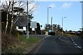
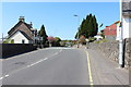
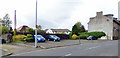
Living in PA13 4QA offers a residential experience defined by its compact scale and strategic location within Scotland. This specific postcode covers a small residential cluster, measuring just 1971 square metres, which contributes to a close-knit environment rather than a sprawling suburb. The area functions as a quiet residential pocket, distinct from the larger commercial hubs nearby, yet providing direct access to essential services. Residents enjoy a setting where daily life revolves around proximity to key transport links and local retail outlets without the need for lengthy commutes to the town centre. The physical footprint of the area ensures that neighbours are often within hearing distance, fostering a sense of community that is characteristic of small neighbourhoods near the Scottish Lowlands. For those seeking a home in PA13 4QA, the lifestyle is one of practical convenience and simplicity. The vicinity serves as a gateway to wider travel options, balancing the calm of a residential enclave with the accessibility of regional amenities. This postcode represents a straightforward choice for buyers who prioritise a defined residential zone over urban density.
- Area Type
- Postcode
- Area Size
- 1971 m²
- Population
- Not available
- Population Density
- Not available
The housing stock within PA13 4QA is characterised by a tightly defined residential footprint, encompassing a land area of only 1971 square metres. Given the small scale of the postcode, the market dynamics are influenced heavily by the immediate surroundings of Kilmacolm and Port Glasgow. While specific sales volumes for this single postcode are limited due to its size, the broader properties in this vicinity have a combined value of approximately 48.4 million pounds. The area consists mainly of council and private housing, with an average tenure length of 12 years. This tenure figure suggests a stable holding period for residents, indicating that those living in homes in PA13 4QA often stay put for over a decade. Such a stable tenure rate contrasts with areas experiencing high rental turnover, pointing towards a settlement of long-term residents. Prospective buyers should note that the limited size of the postcode means very few properties are available at any one time, making individual listings critical rather than market-wide trends.
House Prices in PA13 4QA
Showing 42 properties
Energy Efficiency in PA13 4QA
Daily life in PA13 4QA is enhanced by a collection of essential amenities located within practical reach of the residential cluster. Residents have access to five retail locations, including the Co-op Kilmacolm, Co-op Dubbs, and Lidl Port, which cater to everyday shopping needs without the need to travel further afield. Transport connectivity is robust, supported by five nearby railway stations including Langbank, Woodhall, and Port Glasgow, which facilitate travel beyond the local district. Additionally, two ferry terminals serve the area, namely Greenock and Greenock Custom House Quay, providing maritime links to the outer islands and mainland Scotland. This network of transport and retail options means that living in PA13 4QA does not require isolation; conveniences are integrated directly into the daily routine. The presence of these specific venues ensures that standard household requirements are met quickly and locally, maintaining a balance between residential tranquility and operational convenience.
Amenities
Schools
| Rank | School | Type | Entry gender | Ages |
|---|
Explore more schools in this area
Go to Schools tabDemographics
The community profile for PA13 4QA reflects the demographic characteristics of the surrounding region in South Lanarkshire and the West of Scotland. The population here is predominantly composed of adults, with a council data baseline typical for this postcode showing an average age that aligns with the broader 45 to 46-year-old demographic range found in Campbelltown, Greenock, and Paisley. Self-reported data from Scottish households suggests that the typical resident occupies an average household size of 2.3 individuals, indicating a mix of families and small multi-person households. Educational attainment in this cluster mirrors the wider area, where approximately 54 per cent of the population hold a higher or degree-level qualification, a figure that is generally lower than the 57 per cent average seen across Scotland. House prices for homes in this specific postcode remain slightly below the national average, which is consistent with the economic profile of the location. These figures provide a clear picture of a working-age community with a moderate level of educational achievement, typical of established residential zones in formertowns.
Household Size
Accommodation Type
Tenure
Ethnic Group
Religion
Household Composition
Age
Household Deprivation
NS-SEC
Explore more demographic insights in this area
Go to Demographics tabPlanning
Planning Constraints
- Flood RiskPremium
- Ramsar Wetland SitesPremium
- Area of Outstanding Natural BeautyPremium
- Protected Nature ReservePremium
- Protected WoodlandPremium
- Crime & SafetyPremium