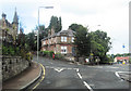
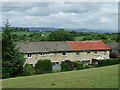
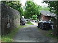
Area Overview for PA11 3EJ
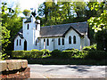
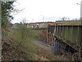
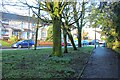
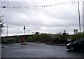
Photos of PA11 3EJ


Area Information
PA11 3EJ represents a specific postcode cluster in Scotland that offers a focused residential environment. This small area covers 7,811 square metres, creating an intimate setting where residents likely know their immediate neighbours. Living in PA11 3EJ means embracing a compact locality that prioritises proximity to essential services while maintaining a distinct identity from the wider Paisley streetscape. The area functions as a convenient node for commuters, situated close to significant transport hubs and retail outlets. Daily life here is characterised by quick access to commuting rail stations and supermarkets, removing the need for extensive travel for routine errands or work commutes. You will find this postcode particularly suitable for those who value a smaller footprint yet wish to remain connected to employment centres like Glasgow. The residential nature of the site ensures a quieter atmosphere compared to the major commercial zones of the city. Buyers should appreciate that this specific location provides a stable environment with clear boundaries between dwellings, making it a practical choice for families or individuals seeking a straightforward address. The small size of the cluster suggests a tight-knit community where local matters are visible and manageable.
- Area Type
- Postcode
- Area Size
- 7811 m²
- Population
- Not available
- Population Density
- Not available
The property market in PA11 3EJ is defined by a strong lean towards home ownership, offering stability for buyers entering the Scottish housing scene. With 966 confirmed homeowners, this figure represents a majority of the residential population, indicating that most families have successfully transitioned into owning their residences rather than renting. This high ownership percentage suggests a robust local investment in the area, where residents are committed to their addresses. The housing stock consists of an estimated 5 housing types, ranging from single residences to larger family dwellings, within the small 7,811-square-metre footprint. Such a variety in a compact area implies efficient land use and a mix of architectures suitable for different household sizes. Prospective buyers looking at this specific postcode can expect to find homes that are primarily owned by occupants, which often leads to better upkeep and community engagement. The market here is not dominated by student accommodation or high-turnover rentals, appealing to those seeking a permanent residence. You will find that the combination of high ownership and varied house types creates a balanced environment where property values remain stable over time. The lack of complex rental dynamics simplifies the purchase process for new entrants.
House Prices in PA11 3EJ
Showing 5 properties
| Address | Type | Beds | Baths | Last Sale Price | Last Sale Date | |
|---|---|---|---|---|---|---|
| Kintail, Watt Lane, Bridge Of Weir, PA11 3EJ | Detached | 4 | - | - | - | |
| Reevesby, Watt Lane, Bridge Of Weir, PA11 3EJ | house | - | - | - | - | |
| Woodgreen, Watt Lane, Bridge Of Weir, PA11 3EJ | Detached | - | - | - | - | |
| Vermar, Watt Lane, Bridge Of Weir, PA11 3EJ | Bungalow | - | - | - | - | |
| The Pines, Watt Lane, Bridge Of Weir, PA11 3EJ | Bungalow | - | - | - | - |
Energy Efficiency in PA11 3EJ
Living in PA11 3EJ places you within practical reach of several key amenities that enhance daily convenience. Retail options are well represented, with five distinct stores located near the postcode. Residents can shop at Co-op Bridge, Co-op Houston, and Aldi Patons Mill RP, ensuring access to essentials, groceries, and household necessities without extensive travel. For those requiring rail transport, five railway stations offer immediate proximity, including Milliken Park, Howwood, and Johnstone. These stations provide direct links to broader networks, integrating the small residential cluster effectively into wider transport patterns. Additionally, Glasgow International Airport stands as a notable amenity just one option away, ideal for frequent travellers or business executives. The blend of proximity to supermarkets and major transport hubs creates a lifestyle focused on efficiency and time-saving. You do not need to venture far for food, news, or transportation; everything required is within a short walk or drive. This concentration of services makes PA11 3EJ particularly appealing for busy families or workers with demanding schedules. The presence of these specific venues ensures that the small size of the area does not come at the cost of convenience.
Amenities
Schools
| Rank | School | Type | Entry gender | Ages |
|---|
Explore more schools in this area
Go to Schools tabDemographics
The community profile for PA11 3EJ reveals specific details about the people calling this postcode home. Data indicates that a significant portion of the local population falls into the 50-64 age bracket, with approximately 381 represented individuals in this group. This demographic skew suggests a neighbourhood that accommodates older residents or families with children moving through various stages of life. Household composition is also notable, with 1,021 residents living in one-person households. This statistic points to a diverse mix of single professionals, retirees, or empty nesters who have chosen this address. Ownership patterns are largely established, with 966 individuals recording themselves as the owners of their homes. High ownership rates typically correlate with greater stability and longer-term residency within the post. The area does not suffer from high deprivation and sits below the national average for economic hardship. This lower deprivation level often translates to better maintenance of properties and a more consistent socio-economic fabric. Residents here benefit from a community that supports varied home ownership needs while avoiding the pressures associated with areas of high economic strain. The demographic makeup also reflects a broad range of ages beyond the 50-64 group, ensuring that the area remains dynamic rather than static.
Household Size
Accommodation Type
Tenure
Ethnic Group
Religion
Household Composition
Age
Household Deprivation
NS-SEC
Explore more demographic insights in this area
Go to Demographics tabPlanning
Planning Constraints
- Flood RiskPremium
- Ramsar Wetland SitesPremium
- Area of Outstanding Natural BeautyPremium
- Protected Nature ReservePremium
- Protected WoodlandPremium
- Crime & SafetyPremium