Area Overview for Newton Mearns
Photos of Newton Mearns


Area Information
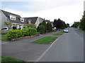
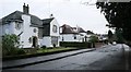
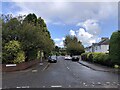
Newton Mearns presents itself as a substantial built-up area covering 8.9 km² within Scotland's North Glasgow suburbs. This community functions as a distinct residential settlement rather than a sprawling rural locale. Residents here experience daily life within a contained environment that balances suburban calm with accessible city proximity. The area serves as a significant residential hub for those seeking a foothold in the Greater Glasgow region while maintaining a separate town identity. Living in Newton Mearns means you are situated in a zone designed for density without the full pressure of a major city centre. The physical layout supports a traditional neighbourhood structure where local streets intersect to form a cohesive community grid. You will find that the area acts as a primary residence for families and professionals working in nearby industrial or airport sectors. The town's identity is firmly rooted in its role as a satellite community connecting residents to broader Scottish travel networks. This specific geography dictates a lifestyle where you commute on defined routes rather than traversing vast undeveloped landscapes. Newton Mearns stands as a practical choice for those wanting a town centre feel without venturing into steep hills or deep countryside.
- Area Type
- Built Up Area 250
- Area Size
- 8.9 km²
- Population
- Not available
- Population Density
- Not available
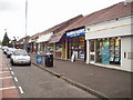
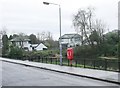
Your daily routine benefits from a long list of amenities located within practical reach across the area. The retail sector offers five major stores including M&S Newton Mearns SF, Asda Newton, and M&S Newton Mearns BP. These locations mean you can handle weekly shopping without travelling far. Public transport links are equally well developed with five railway stations serving the neighbourhood. Patterton Railway Station, Whitecraigs Railway Station, and Williamwood Railway Station provide regular services to Glasgow and beyond. If you prefer underground options, five metro stations including Kinning Park Underground Station, Cessnock Underground Station, and Shields Road Underground Station are nearby. For those needing ferries, five landing points such as Glasgow Science Centre North Quay and Glasgow SECC Ferry Landing offer water access. These transport nodes ensure you can reach work or leisure destinations quickly. Five nearby shops and services create a convenient local high street vibe where you can grab coffee or lunch instantly. The variety of transport modes gives you flexibility when planning your weekly schedule. You do not need a car to run basic errands or visit friends in the city. The sheer volume of nearby facilities reduces your reliance on long commutes or crowded roads.
Amenities
Schools
| Rank | School | Type | Entry gender | Ages |
|---|
Explore more schools in this area
Go to Schools tabDemographics
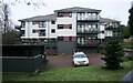
The community profile of Newton Mearns reflects a population with established household structures and varied living arrangements. Detailed breakdowns of age distribution, household types, and cultural diversity figures are not included in the current data set. However, the area supports a mix of family homes and independent living spaces typical of Scottish suburban towns. The absence of specific demographic statistics prevents a precise numerical profile but suggests a standard residential composition. You can assume the population includes long-term residents alongside new families drawn to the local schools and amenities. Home ownership levels and rental market splits remain unquantified in the comprehensive records available for this specific location. Instead, the focus remains on the physical reality of the neighbourhood you inhabit. The area accommodates second homes, rental properties, and owner-occupied flats created during various development phases. Quality of life measurements specific to deprivation indices or income brackets are not available for analysis. Residents navigate their daily routines without the statistical baggage of broader national averages. The community functions as a self-contained unit where social interactions happen on street corners, in local shops, and on public transport links. You live among neighbours who shape the culture through shared use of parks and stations rather than data-driven categories.
Household Size
Accommodation Type
Tenure
Ethnic Group
Religion
Household Composition
Age
Household Deprivation
NS-SEC
Explore more demographic insights in this area
Go to Demographics tabPlanning
Planning Constraints
- Crime RiskPremium