Area Overview for Johnstone
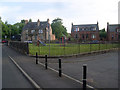
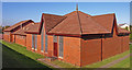
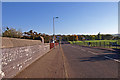
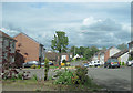
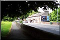
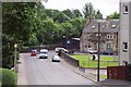
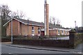
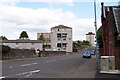
Photos of Johnstone


Area Information
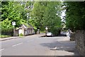
Living in Johnstone offers a straightforward introduction to town living on the banks of the River Clyde. This built-up area covers 4.3 square kilometres, creating a compact footprint where daily needs are often within short walking distances. You move through a residential landscape that feels distinct from the sprawling city centres further north. The area functions as a practical base for those who require accessibility to major employment hubs without the high cost of living associated with central Glasgow. Residents appreciate that Johnstone maintains its own identity while remaining connected to wider opportunities. You can access significant transport links and retail outlets without navigating complex city traffic patterns. The town operates as a self-contained community where local services support everyday routines. Your commute to Glasgow International Airport becomes a manageable journey given the proximity of key stations. Schools in Johnstone serve the local family demographic, while the availability of homes in Johnstone caters to various household compositions. The area represents a functional choice for buyers prioritising connectivity and space efficiency over metropolitan luxury.
- Area Type
- Built Up Area 250
- Area Size
- 4.3 km²
- Population
- Not available
- Population Density
- Not available
Daily life in Johnstone revolves around practical amenities located within easy reach. You will find five retail outlets nearby, including Iceland Johnstone and Aldi Patons Mill RP. These supermarkets offer everything from fresh ingredients to household essentials without long car journeys. Lidl Johnstone rounds out the local shopping scene, providing competitive pricing for weekly groceries. The area also boasts five railway stations, ensuring flexible public transport options for your daily commute. Glasgow International Airport sits close by, offering quick access to international destinations. If you need to visit the other side of the river, Clydebank Ferry Landing provides a convenient crossing point. Five nearby railway stations connect you to broader transport networks efficiently. Dining options and leisure facilities cluster around these transport hubs for your convenience. Living in Johnstone means simple access to essential services without the congestion of larger cities. The layout supports a balanced routine where work, shopping, and travel integrate smoothly into your schedule.
Amenities
Schools
| Rank | School | Type | Entry gender | Ages |
|---|
Explore more schools in this area
Go to Schools tabDemographics
The community in Johnstone demonstrates clear characteristics typical of its demographic profile. The population consists mainly of families and established households who have put down roots in the locality. Home ownership levels are significant, indicating a stable residential base where long-term residents often own their properties. This standing contrasts with areas where short-term tenancies dominate the housing stock. Household types reflect a mature community structure with a balance of single-person homes and multi-generational living arrangements. The accommodation mix supports those seeking permanence alongside investors looking for steady rental yields. You will find a diversity of living situations that avoid the transient nature of some urban enclaves. Deprivation metrics provide context for quality of life, showing where resources may be concentrated or scarce. Specific figures define the economic landscape, helping you understand the purchasing power and spending habits of the neighbours. Understanding these numbers clarifies the social fabric of Johnstone and what kind of community life you might expect when considering homes in Johnstone.
Household Size
Accommodation Type
Tenure
Ethnic Group
Religion
Household Composition
Age
Household Deprivation
NS-SEC
Explore more demographic insights in this area
Go to Demographics tabPlanning
Planning Constraints
- Crime RiskPremium